Showing posts with label the suburb. Show all posts

Thursday, April 15, 2010

From Savannah to the Burbs: The American Art of Subdivision


Suburban Surreal, originally uploaded by Ann Douglas.


An Odonomy of Savannah IV: Origins


~ part i ~

the insight of subdividing


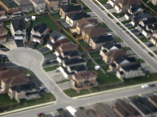
From the air, the suburban subdivision is a puzzle. If E.T.'s ever came to earth and sized us up, the subdivision would probably first strike them as a bizarre social experiment in utopian egalitarianism. But then they would notice its preponderance across the North American landscape. Looking out of airplane windows, I’m always struck by its almost comical ubiquity. We, however, would argue that a subdivision's denizens pursue nonesuch experiment. How then to explain the penchant to settle in the burbs? Why does the subdivision struggle so heroically to be repetitive...to seemingly synthesize, codify, endlessly erect sameness? Doesn't this seem a little bit at odds with Americans' hedgehog compositions and our open admiration for the rugged nonconformist--the James Dean rebel who has little if any regard for the sized-up Joneses across the street? That cul-de-sac above is a curious form for the land that loved Thoreau and Robert Frost, even if it is literally a road "less traveled by".

What is this need to create the monocultural clumps of that suburb? Is this tendency to segregate into one's general social strata the fault of pro-forma driven developers that do not like to offer variety? Directly, yes, people buy what they have available to them to buy, and they tend to buy the best of what they can afford. Developers simply deliver the baseline expectations for what Americans expect in a home of a certain price range, and it is convenient for them to knock out those homes assembly line style.

But would Americans easily purchase that same new home in a subdivision development whose overall pricepoints and socio-economic target demographics varied greatly at the outset? I suspect not. I suspect people would still prefer neighborhoods where their home “fit in”. And I think they do take into careful consideration what kind of neighbors they are going to live around. I don’t know if it is necessarily something wired into the human condition that we prefer our neighbors to look as if they are equally well off (or poor) as ourselves, but obviously the subdivision is a testament to the fact that folks like to be around the kind of people they relate to (even if they never get past “hi”).


Perhaps we need to unpack this cultural condition more. Savannah shares an interesting characteristic with the typical suburban subdivision. I want to attempt a taxonomy (odonomy) of Savannah's streets in this series, but first I have to puzzle over the question of Savannah's origins, for to fail to see its essential module, the 60' x 90' town lot repeating ad infinitum, is to miss the functionally critical progenitor of Savannah's form.

Savannah's streets are a consequence of this city's colonial settlement pattern, a grid of town-lot wards that are interlaced with a 7-street order of contiguous streets, creating a cohesive and variegated street fabric that (nonetheless!) was arranged to serve identically sized lots. These town lots were much more size-constrained than the typical homesteading parcels given to settlers elsewhere in the colonies and curiously close to the size and shape of bungalow lots in our prewar suburbs. Even William Penn’s grided plan for Philadelphia assumes a much greater variety of residential parcels, some of its estate lots larger than an entire Savannah ward. Judged by contemporary standards, Savannah’s historic district was at its outset not much different than the typical prewar (grid-type) subdivision often found in our inner ring suburbs.

Savannah’s fabric of repeating wards of 40 identically sized town lots arose from the need to settle a colony in as fair, attractive, effective and efficient a manner as could be conceived for its purpose (seems familiar, huh?). A single formal syllogism drives Savannah's form: because all the lots are to repeat in size, the wards are to repeat in fashion.

Source: UGA Hargrett Rare Library Map Collection

Founded in 1733, Savannah's parcelization schema was a partial solution to the trustees’ desires to establish a Southern colonial economy not predicated on slave labor (you could say Savannah's trustees were early forerunners of the kind of social reformers that spurred the abolitionist movement). Thus, settlers had to be accommodated with homesteading tracts of land, which single families could then independently farm. But Savannah was also a frontier port on land heretofore and precariously claimed by Spain, and the needs of defense required that all families also be able to live in close proximity. So, a tiered land-allotting strategy was devised. Not only were all the settler families to receive identically sized town lots, where their actual homes would be erected, but they were also given rights to equal allotments of 45-acre farm plots in the hinterland south of Savannah. In addition, they were given smaller garden lots of five acres each closer in to the city, in a kind of "greenbelt" phalanx on either side of the common land held directly south of the city.


 Plan of the Forty-Five and Five Acre Lots in the Township of Savannah


Source: UGA Hargrett Rare Library Map Collection


Carefully inspecting the arrangement of the 45-acre farm tracts, however, one can discern that they were arranged in a manner to encourage the future formation of hamlets and townships in the countryside, suggesting a fractal strategy of expansion for the entire colonization scheme of Georgia. One must appreciate the trustees’ clever anticipation of the regional diversification of labor over time. As the countryside developed into farming communities, Savannah's trade port economy would allow it to urbanize, allowing more of its residents to sever from field labor as they transitioned to more service, manufacturing and trading occupations over time. Using their town lots as the family business center, this is in fact how Savannah urbanized. Eventually the satellite allotments were anticipated to be parceled out to posterity or to others, as the city expanded and the hamlets urbanized with an influx of colonial migrants. At the outset, however, everyone was encouraged to contribute to the needs of defense (hence the town lot) and cultivation (hence the satellite garden and farm plots).


Close-up Detail of the Forty-Five and Five Acre Lots Map
What is noteworthy about all this, especially in accounting for the agrarian based economy of the American colonies, is that Savannah did not socialize or replace (with slave labor) the need to homestead. Rather, it sook a different way to make the cut. In Savannah, the act of subdividing itself represented a generative, economic act (as well as a pragmatic solution and moral imperative). It reconciled the acts of urbanization and agrarian development, which were so awkwardly accounted for in the plans of other colonial settlements, William Penn’s included. It had the insight of the fourth dimension.

Already at its founding, this arrangement between private allotments, town-garden-farm, set up a north-south commuting pattern, which, to this day, is a functional strength of Savannah’s grid (I’ll discuss how later in a future installment to this Odonomy series).


I find the trustees’ tripartite subdivision strategy quite inspirational on a number of levels. It is certainly suggestive of applications for sustainable regional planning and urban design today. …The thing that amazes me about Savannah, America’s first equal-lot subdivision, is how many planning insights it never ceases to evoke. In this case, we really should contemplate revisiting one of our starting blocks.


To be continued...


(Next week, I’ll discuss Savannah’s conceptual origins and tackle that tricky matter of “equality”.)

Sunday, March 21, 2010

Welcome to the Next American Suburb

A New Model of Suburban Development? This photo demonstrates some smart neighborhood development features of note. Here are just some of the elements: (a) A greenway crossing in the foreground; (b) Bike lanes, but more importantly, roadway and neighborhood conditions that generate frequent bike trips; (c) Children (in the background crossing the street); (d) Townhomes (at right) populated by households that include said children and which suavely wrap around a super market and its parking lot; (e) In the background to the left is UNC Hospital's Wellness Center - basically a Y souped up with clinical services, therapy/rehab services and a rich array of preventative health-care and community supportive programs; (f) In the background, in the distance, is a retirement village center

I have recently come across an interesting community development that I believe is a compelling model for the next stage of "edge city" development. This is Meadowmont in Chapel Hill, N.C. I see in Meadowmont a transformational model that can re-mix and consolidate the separated uses of a typical suburb into a form whose smart-growth strategies effectively liberate Americans from that 7-day-a-week vehicular co-dependency that leads to sedentary lifestyles. This, and doing it in such a way that Meadowmont may actually represent a viable market model that has the thoughtful ingredients for successful replication. If LEED-ND has a version of Levittown (a development model that replicates), this might be it.

Among other things, Meadowmont offers yet another great example of what can be achieved with more tightly coordinated commercial, institutional and residential development - working in tandem with a cohesive, multi-modal neighborhood transportation strategy. As an urbanist, I have to be attuned to what is working in the market, and I think Meadowmont is an implemented precedent that offers great lessons to appreciate and chew on. I share here just a visual survey and some cursory comments. I think we can easily spot in Meadowmont (following in the trope of family-appealing New Urbanist developments such as Denver's Stapleton) some subtle but significant innovations to integrating a richer array of lifestyle services with neighborhood development, and which can create a market draw for them and can potentially entice capital markets to - not just embrace - but promote smart(er) growth. There are enough ideas here to warrant further contemplation, which I hope presage where development in the suburban periphery may be heading soon. (I must say... I would not mind it at all if Beazer, Centex and Pulte began to copy and paste some of the innovations Chapel Hill's signature development affords us.)

1) The interesting heart of the community is the UNC Wellness Center at Meadowmont, an impresive, greenway-hugging, environmentally friendly preventive health care and fitness center facility. If hospitals actually thought their job was to keep their clients healthy (not just treat their illnesses), they would probably create wellness centers right smack in the middle of their clients' communities.


2) Every generation shares a piece of the pie. The elderly are thoughtfully accommodated within closer proximity to the services of the community. The Cedars of Chapel Hill below is a continuing care facility facing a central, generous green and full-service community center. The Cedars are in close proximity from the town center and directly across the street from the Wellness Center above and the grocery store. An apartment complex buffers the retirement village from the busy arterial road.


2) The grocery store
(a Harris Teeter) is located centrally near the arterial and surrounded by townhomes. Where you would typically have a 20-40 foot commercial use setback filled with berms and water-needy plantings, you raise instead townhomes that eventually become populated with loyal customers who arrive and depart by foot and who no doubt visit you more frequently than other customers. Cha-ching.


3) Greenways
and multi-use trails connect all the dots. The central spine trail follows the main valley streams flowing through Meadowmont, the primary conveyances of storm water. This trail connects to crossing trails that offer crossing points across the stream, helping to tie the different parts of the neighborhood and its uses together. They actually offer a completely equivalent transportation facility (see below) which more directly connects uses to one another than the actual winding vehicular streets, meaning, walking and biking become more enticing options. Notice, by the way, that the backyards often open up to the greenway, giving the trail an intimate connection to the community. This means residents, especially children, have great access to the greenway and help keep it secure. (Contrary to logic hinged on parental paranoia, the presence of children is actually the very thing that helps keep an area safe and secure - if children are present, others use and enjoy the facility much better, and fear encounters with strangers less. More people on the trail then help keep the facility safer. It is a mutually reinforcing phenomenon.)


4) The neighborhood elementary school is located unobtrusively in the neighborhood, in a lower plain by the stream, well-below the tree line of the overlooking street. All the classrooms are directly connected to the outdoors via a colonnade which shades the outdoor learning spaces associated with each class room (like the arcade schools of the classical era). The school itself is generously daylit and is smartly comprised of three east-west oriented wings. But the most noteworthy thing about the school is that it can be accessed by the greenway trails connecting to the residential subdivisions surrounding it. I loved the covered bike parking facility (by the way, there is only one bike because I took the photo at 5 pm ...this bike is probably a teacher or staff-person's).


5) Luxurious townhomes ring the hill tops much like fortified Italian hill towns. Unfortunately, we see here some examples realizing current urban design fetish for employing greens-in-the-round, but at least the circular form here is suggested by hilltop topography ...unlike the useless usual. However much I sincerely doubt Jane Jacobs wanted us to invert the Panopticon, for all I know, these residents will want their "eyes on the park" in order to keep a careful watch over things.


6) These soccer moms can punt the minivan. This soccer field, I kid you not, does not have any vehicular access to it! Located across the stream from the elementary school, the only access afforded is via a bike path.


7) A head-turning mixed-use strategy represented by Meadowmont is the attempt to mix residential uses in an office building. Office uses represent a security liability, being depopulated at night, and thus typically require night-time security. The upper level of this office building helps to secure the building by allowing the upper (terraced) level to be used as luxury residential condominiums, granting it 24-hour use. This office building, along with the large detention basin it overlooks, also helps buffer the community from the arterial road. A bike path tunnel, crossing underneath the road, connects it to the office park across the road. I'm not sure how successful this residential-mix strategy is going to play out (the building is not rented out yet), but the sign advertising the potential uses definitely made me do a double-take.


8) But ...Meadowmont's strategic, multi-modal transportation integration is what really gets me excited about the future of suburban expectations in Chapel Hill. I note that planners have been insistent on providing an "equivalent facility" approach to bike-path integration (photo below left). Along the limited access arterials, that's where you put your wide bike thoroughfares on both sides of the road, and you create crossings wherever you can. This is the policy of Hilton Head Island as well. I welcome the raised expectations this will create for future development whole-heartedly. I also am warmed by the fact the office parks along Raleigh Road (the arterial I've been mentioning above) are circulated by compact, express buses at commuting times (photo below right ...taken between 6-7 pm).


...But of all the things I'm warmed the most about future of Meadowmont, and its potential long-lasting success as a model for greenfield development, is the fact that it has a good shot to be serviced directly by the TTA's future LRT, on the link connecting Chapel Hill to Durham. We all need to congratulate Chapel Hill planners for very conscientiously locating this TND, as Jarrett puts it, to be on the way. Between just the handful of smart growth principles mentioned above, think of how many vehicular trips Raleigh Road has been spared in the long-term.