Showing posts with label odonomy. Show all posts

Monday, October 3, 2011

A Freeway in the City, Of Big Bosses and Big Digs


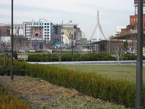
Rose Kennedy Greenway, originally uploaded by Dan Bock.

The story of America has always been a story of large personalities. As 21st Century urbanists, we look at the transformation of late 20th Century urban America and can’t help noticing how large personalities like Frank Lloyd Wright, Le Corbusier and Robert Moses played a role seemingly promoting the postwar demise of America’s cities, a reading partly propped by Jane Jacobs’s Death and Life of Great American Cities. Interestingly, this reading may be one of the ways that we continue to flatter ourselves as urban designers. As products of planning and design school, we like to believe the enterprise of urban design matters greatly to the illth and health for America’s cities. Now that we got our utopias in line or much sobered up and humanized, why, let’s clean up the splatter left by the reign of modernists.

Uhm… Was it really Wright and Corbu that did us in in the first place? Was it the boing-o headed utopias of these bad boys of architecture that gave us separated land uses, dehumanized cores and sprawl-burbs? What actually did contribute to the postwar demise of America’s cities?

Frank Gruber has been doing a lot of careful thinking on his Huffington Post blog on this topic. As an entertainment lawyer and Santa Monica Lookout News columnist, Gruber sure does an exorbitant amount of reading and thinking on the topic of urbanism. But (maybe because he is not an architect?) Gruber does not spend much time on contemporary urbanism’s favorite whipping boys and, in fact, thinks little of them in his attempt to figure out why America destroyed its great cities. In a provocative arc that has been unfolding over the past year on his blog, Gruber’s attention has turned to his current working lineup of “suspects” behind city-murder. Interestingly, his latest post is a review of Earl Swift’s The Big Roads: The Untold Story of the Engineers, Visionaries, and Trailblazers Who Created the American Superhighways, in which Gruber has come across some really big bosses who may have actually played a leading role in the demise of urban conditions in America, and they are not the persons most urbanists have probably even heard of. The biggest one of these was the technocrat Thomas MacDonald, who spent a whopping three plus decades (from 1919 to 1953) as head of the Federal Bureau of Public Roads (the predecessor to the Federal Highway Administration). It was MacDonald who crafted the flesh and bones of the 1944 highway bill that created the downtown slicing interstate system of highways, which the 1956 appropriations bill implemented wholesale without anyone really inspecting the particulars, much less the implications, of the national plan.

While superhighway construction helped disperse industrial activity and middle class habitation to the periphery, a real devastating effect was taking the freeways into the center cities themselves. Gruber summarizes why this was important to our postwar cities since, unlike Europe, where cities preserved the traditional fabrics of their transit-served cores by stopping suburban limited access highways at a ring road around the core, Americans wanted freeways to connect to the center “under the profoundly mistaken view that their cities would revive if they were connected to the suburbs by high-speed roads.” Gruber notes that the key decision to bring freeways into cities, “was never debated in a meaningful way”.

I would add to this: we still have not had this debate! Gruber lists the epic Big Dig among the efforts to repair the freeway incisions, which is a seriously wasteful example to contemplate in repairing freeway incisions to the core. In fact, it demonstrates the opposite. We should not have had a Big Dig, except maybe to park the cars right there. (Louis Kahn’s plan for terminal parking in Philadelphia at immense parking-deck “harbors” serving the downtown thresholds was a pretty darn good solution for a modernist, I must say.) The right to go right in to (and in fact, more accurately, through) downtown via freeway is so tied up to our unconscious conceptions of how the city should function, that we don’t even bother to question it. Not long ago, Jarrett Walker’s fictional city for a transit network planning game he devised was roundly critiqued for its seeming lack of freeway "completion" on his blog Human Transit. Jarrett was surprised that he had to defend his decision to stop the freeway before the core, pointing out some obvious North American examples that spared the core.

That we have not yet had a holistic debate about this even among urbanist circles is telling enough. Still the urbanist solution appears to come down to "capping" downtown freeways. An image of the wind-howling linear park over the Big Dig was used to tout it as a good precedent recently by the consultants presenting the Charlotte Center City Partners’ 2020 Vision Plan (a similar park is being proposed to cap a portion of our downtown loop). Tellingly, (unlike the photo above) not a single person appeared in the photo. A transit engineer I know and I looked at each other, each of us thinking the same thing. Immediately, he started sketching on his napkin. He sketched a map of the downtown freeway loop and started “X”-ing out the lower southern section (the part we call the John Belk Freeway), implying to take out the redundant lower section of our very small and tight-curved inner freeway loop. Easily, I grasped the immense power of his solution (yes, engineers can think brilliantly about urbanist solutions too!). Immediately, visions of a wide boulevard with a welcoming median replacing the loop came to us, with multiple rows of trees and maybe with active and passive uses in it, as in median promenades in Paris. Such a boulevard – by also separating faster through traffic from slower local traffic – could easily improve the traffic needs of the city by granting drivers immediate access to the grid, instead of bringing them to limited interchange chokepoints that actually slow everyone down. This very act of healing the sutures, by removing all the ramps and network barriers to funnel off traffic to them, would also open up the highly fragmented conditions of the adjacent grid two blocks deep in either direction, greatly connecting the city vastly more than imagined by the said meager capping, which just covers over the traffic backing chokepoints (a proposal for the capping can be found here; in fact, this particular proposal would even worsen traffic since it would demand additional rerouting in the fabric).

By offering a grand boulevard to front to instead, suddenly you are not only augmenting, but creating more value to all parcels adjacent to John Belk Freeway. Instead of looking at an immense freeway chasm, buildings will be facing a green boulevard supporting urbanism! All of a sudden you’ve created an amazing asset for the city around the entire southern periphery of our downtown, a far greater impact than the three-block long capping park proposed.

There is plenty of room here...

Click on image to view in Google Maps

...To do this in Charlotte:

Click on image to view in Google Maps

Part of the reason why we haven’t had this debate meaningfully in our country about the actual need for freeways to go through our downtowns, I think, is because of that form-obsessed, architecture-based mythology of urbanists that blames modernism for everything. This myth constantly sidelines urbanists from talking cogently about freeways (we prefer to talk about the problems with buildings). For someone who talked so much about the street and who was a key activist fighting Robert Moses’s plans to cut a freeway through Manhattan, Jane Jacobs notably does not mention Thomas MacDonald even once among her historic cast of evil-doers in Death and Life, all of whom have by now become the “usual suspects” of separated use, road-based, sprawl promoting planning. (I find this dearth of freeway talk in Death and Life very strange. Jacobs, notably, left Frank Lloyd Wright’s name off the list but disparaged Lewis Mumford amongst the gang of the usual suspects—who, ironically enough, actually led the late counter-charge against MacDonald and his downtown-slicing plans.)

Perhaps in obsessing on the forms, the hubris of the profession has detracted us a bit from the energy transferring mechanics that would most effectively “retrofit” America’s cities back to their greatness.

Friday, November 19, 2010

The Joy of Biking DC

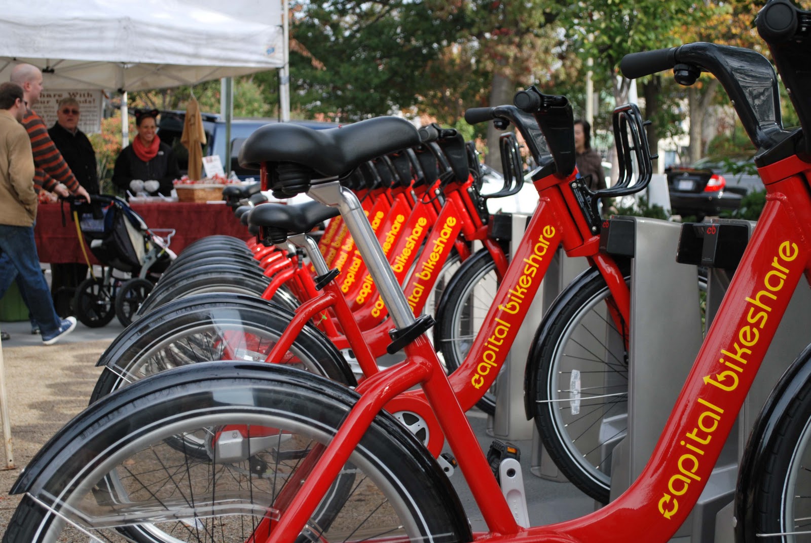
Bike share station in DC's Eastern Market
I spent much of my Halloween weekend in DC on a bike.  I was in DC to run the Marine Corps Marathon on Halloween, my first time ever attempting 26.2 miles, but on the days leading up to the race, I couldn't stop myself from punching it down those DC avenues on my rental, swerving from from one multi-lane avenue to another.  Pedaling around our capital city was an exhilarating experience.  Yes, my virgin marathon began with a little bit of telltale tightness in my hams, but it was worth it. (Yes...I finished the marathon.  The whole experience running MCM was thrilling...It certainly will not be my last 26.2!)
Surprisingly lucid thinking in DC

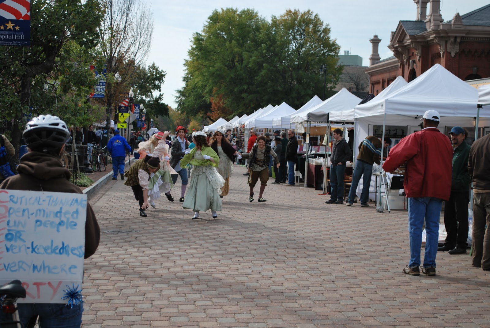
Short and sweet though my time was, I have now run and biked the District enough to become convinced that DC just might be the perfect city for both activities.  It is also the perfect city for rallying, which I did (along with the sign-bearer at right) that Saturday at Jon Stewart's Rally to Restore Sanity. That's an aspect of DC's virtues that requires travel of that more noumenal variety (the kind that tends to gum up Proper Scale enough), so I'll avoid it for now.

As for biking, never before have I traveled so happily down trafficky streets and avenues.  The thought dawned on me quite fast that this was not my typical urban biking experience.  I had to pause a moment to ponder about what made DC feel so different...

Pennsylvania Avenue
Was it the wide avenues?  Perhaps the generous amount of pavement everywhere in the District allows enough traffic slack to grant the cyclist some breaks to get in and out of traffic lanes easily, but (with the exception of Pennsylvania Ave. at left) you take your life into your own hands down many of these.  Let's put it this way, you need to be comfortable with clearances just inches between yourself and moving vehicles.  The thing that made a positive difference in my experience getting around on a bike in DC, as compared to my experience in Boston and Jerusalem, is hard to tag (in Charlotte, people, I don't even try). But this I noticed was something I appreciated about DC's Avenues: they run enough interference on faster traffic (due to congestion produced by plentiful merging points and intersections) to keep traffic at an even keel and closer to cycling speeds, while at the same time offering longer stretches of uninterrupted travel, which make both cyclists and drivers happy.  For cyclists, stops are just as annoying as for drivers in the grid; in fact, even more so, since having to stop at an intersection means breaking your hard-gained momentum, which is what allows you to stay at travel speeds matching the traffic alongside you.  Staying at these higher speeds allows you to safely share the road with vehicles, and, in fact, take command of a lane when necessary.  These kind of sharable arteries, with highly pedestrianized urban street fronts, are rare here in the States.  But DC is thick with them!  Because they are everywhere, traffic tends to be evenly distributed.  Even if they mess with your sense of orientation, these wide streets have a certain predictable pace, almost a kind of ordered, lolling behavior, that the cyclist picks up on intuitively and can use to his or her advantage. 

Approaching Eastern Market
Was there a difference also in the amenities?  That signature bikeway on Pennsylvania Avenue is a joy to ride down, certainly.  Some of the world-class city offerings, including the Capital Bikeshare program, were there, and I am sure these do much to encourage bike travel in DC. The bikeway network, on the other hand, was the limited-run variety rather than the comprehensive kind.  But I noticed that the bike lanes that do exist are actually necessary and do go a long way to make a difference, especially when they are actually needed to create some clearance for the cyclist to bypass backed up traffic, therefore granting the bike mode a coveted edge (and also allowing the cyclist to stay off the sidewalks to bypass such conditions).  Some of these lanes, as in the busy narrow streets in the Eastern Market area, make very obvious why bike travel in DC has long gained the favored mode status for many locals.

While planners like me riding around DC might quibble that the bike lane network is patchwork at best, I would say that not all the conveniences and provisions for bike travel across greater distances in the city are really needed.  Sure, judged by mere infrastructural capacity, DC's travel split on the surface is still skewed heavily toward the automobile.  As the images on the blogosphere today betray, New York today and, certainly, Portland are doing somersaults over our capital on this score. But DC has a whole lot of other pluses and lessons for improving bike travel.  Some of these may even obviate the need for the white stripes and pavement dedications.

A very sane cyclist observes an outdoor performance of the Pirates of Penzance unfolding at Eastern Market

Of course, the key ingredient making DC special is L'Enfant's grid.  It is, to be brief, a difference of amenity inherent to city form. When it comes to biking, city form is the first thing bike-supportive planning should think carefully about. Too few of us spend time thinking about it, although we deal with it implicitly if not directly in design.  When you are working with the right fabric, maybe you don't need the Portlandian exuberance with bikeway infrastructure.  DC seems to teach that maybe these solutions should be implemented only when they are actually necessary.

After a couple weeks mulling over my experience, I have slowly come to the realization that, in fact, L'Enfant's grid just might be peerless in its advantages for integrating multi-modal transportation effectively in heavily traveled districts ("might be peerless" ....I'm not yet ready to claim it outright, though I'm tempted).  The advantages that make bike travel special in DC are also the same advantages that make travel of all other modes there effective.  L'Enfant did DC a huge favor not only in giving the heart of DC wide, Parisian-style rights-of-way but in designing radial avenues that lace across DC's grid diagonally with respect to the rectilinear infill grid, giving DC plenty of what I call (as I've modified for my private odonomy on this blog) "Grand Avenues".   Grand Avenues help everyone.  They help motorists, cyclists, pedestrians, buses and even the underground subways with stations leading out to them (I'll explain why later).  Even when the pavement stops, Grand Avenues may still continue for pedestrians (such as across the rolling lawn of Capitol Hill for the pedestrians headed from the Eastern Market area to the Rally to Restore Sanity at right).  A city's Grand Avenues, it seems, get inside the heads of its citizens.  They seem to amplify the pulse and vitality of the city with what they connect.

Bike parking at our national public forum
DC, unlike every American city I know, splits traffic flow with avenues (instead of simply channelizing it to them).  It disperses and modulates traffic flows enough to make wide surface streets sharable between cyclists and vehicles.  All those skewed intersections simply multiply travel options.  In the cases where it doesn't, and the traffic is simply too thick and relentless to allow the cyclist the direct route option, the cyclist often has the option to navigate quieter local streets that circumvent the artery traffic. 

Previously, the precedents presented by places like Copenhagen and Portland led me to believe that the urban design challenge was to find ways to claim more pavement for the bike.  But DC seems to have taken the opposite tact, brazenly maximizing surface provisions for the automobile instead.  With all its rights-of-way, L'Enfant's city seems to have passed a sweet spot.  Instead of corralling and flagellating it, avenues here seem to placate traffic behavior, letting it switch often and lead more directly to its destinations. Sure, radial avenues intersecting at odd angles with the grid insert even more intersections than needed into it (maybe these serve a good purpose we're not appreciating?), and often these are the skewed kind of intersections that imagination challenged DOT's detest (and don't allow you to design, that's for sure!).  But, ...I rode a bike in DC, and I can't remember the last time I had as much fun on a bike...

Sunday, October 17, 2010

A Savannah in the Desert?

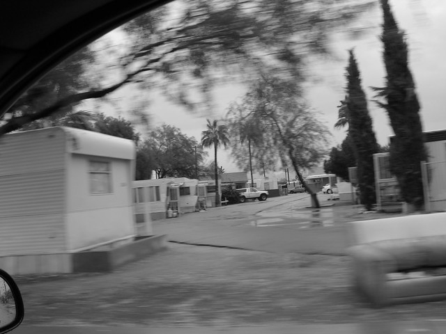
There's Flickr, and then there's Mesa #9

An Odonomy of Savannah VII: A Tale of Two Grids

~ part ii ~
inertness and porosity

Of all the random, visually interesting development patterns I've stumbled across on Google Maps, the trailer/RV parks of Mesa, Arizona sure compose some intriguing aerial ruminations. Unlike the garden a la francaise interests that sometimes appear in aerial photos of suburban subdivisions, what strikes me most about Mesa's patterns are the rectilinear and simple geometries they playfully vary in Mesa's half-mile arterial grid fabric. Here are examples of what I mean:


The brutally efficient compactness of these trailer park patterns, jiggling and permuting different ways within their self-absorbed perimeters, makes one's eye squint a bit at the optical glare produced. Indeed, the bright roofs of the densely packed units are a noticeable feature of Mesa from earth orbit. The bright band in the center of the Mesa area aerial below represents these trailer parks from on high, which are abutting Mesa's Main Street/Apache Trail east-west artery, cutting right between a contrastive greenish swath of sprinkler-squirting Arizona subdivisions:


One can't help to wonder if these trailer parks reflect a lot of solar radiation away from the Phoenix area, and one even suspects a collective recoup here of sorts in lieu of Mesa's heat-island contribution to net global-warming impact. I wouldn't even be surprised if they also help make up for that indeterminate bit of glacial retraction and polar snowmelt that Mesa's emissions produce.

Regardless, I, of course, can't help but to notice the formal similarity between these developments and a Savannah Ward.

Here, for example, is a typical Mesa/Apache Junction trailer park development:


Compare with a (more residentially comprised) Savannah Ward...


For the heck of it, here are other variants of Mesa's trailer parks:


In the above examples, notice that the community/leasing complex usually in the smack center of the development appears as a staple Mesa trailer park amenity. Notice also the way the main drive of the development ties head-on to the complex, much like Savannah's signature north-south streets that lead directly (and encircle) the garden squares. Moreover, these entrance drives tend not to be loading streets, but what I define as "avenue" types that channel travelers directly (and sometimes ceremoniously) to destination points as their predominant function. Of course, the Mesa developments are much larger than a Savannah Ward, up to six times in size even, but the shared community amenity is, very interestingly, roughly the size of a Savannah garden square.

What's most interesting to me about the above comparison, however, is the near similarity in dimensions between Savannah's original town lots, which vary slightly more or less than 60'-0" by 90'-0", and a typical Mesa trailer lot, usually sized around 55'-0" by 80'-0". In some locations, Mesa's developments even have what appear to be woonerf-like open, semi-shared "backyard" spaces in the block interiors (between the rows of mobiles), a tantalizing equivalent to Savannah's intimate residential service alleys. While it, of course, developed more densely and compactly over time, Savannah's present form has evolved out of town lots just a little bit bigger than these Mesa trailer lots. In fact, in some of the more residential squares, Savannah's lots have subdivided further into lots much smaller than the trailer lots, but in a hardly noticeable manner. It's hard to imagine that two or three stately Savannah Victorians can fit in an area not very much larger than a Mesa trailer lot, but they do...and this they do in Savannah with a kind of quiet, comfortable manner that brings added intimacy to their street-setting:


The three detached Victorians on the left share what was originally a single 60' x 100' Savannah town lot

All this begs the intriguing question, could Mesa evolve over time into a kind of "desert" version of Savannah?  Well, if you just glance at the image of a Mesa trailer park by Flickr poster kevindooley (at the top of this post), one can easily begin to imagine suggestive possibilities for a desert-scaped woonerf.  (Why, my landscape urbanists out there in AZ, just turn that couch into a Diller Scofidio park bench and you're already 50% of the way there!)  Unfortunately, the challenges for such a transformation are more daunting than that, of course.  Which brings me back to a critical asset of Savannah's "Two Grids".

I mentioned in part i that Savannah has two literal overlapping grids.  One primary grid handles most of the vehicular traffic work-load, and serves as Savannah's equivalent for Mesa's half-mile segmented arterial grid.  But the other grid of Savannah, which handles the local traffic and much of the ped/bike movement, is not just a discontinuous local/collector/service network but, in great distinction with Mesa, is a true grid, which holds its own integrity from ward to ward.  Savannah's contiguous secondary grid is the unique asset of its form, a profound quality of Savannah's form worth interrogating and experimenting with in our form investigations for cities.  The two-grid system synthesizes Savannah's economic diversity to the very specific circumstances of its public realm and harmonizes its transformations.  

In part i, I went so far as to claim that Savannah's fabric is "open" in its synthetic function, in that uses and their interrelationships are not pre-determinately set or stiffly delimited and are seemingly allowed to transform over time, in distinction to top-heavy and ready city planning approaches. But, I'm realizing "open" might be a bit of a misleading term, and misapplying the takeaway, if one interprets this modifier as "randomizing" or politically-neutering the act of development or, even more, as contemplating some theory of libertarianism.  Rather, I dealt at length in that post with exactly the more mundane and determinate exertions of Savannah's form on land use and transportation decisions in Savannah.  The truth is, Savannah's form must be socially negotiated continuously, as all inhabitants must in every city, but, what is somewhat novel, is exactly how Savannah's system-like form "tunes" and harmonizes these negotiations.  Form and negotiation travel here hand-in-hand in a noticeable way, and both build upon each other.  They make Savannah's invisible "rules" of city transformation legible to the historically reflective eye.  Today, however, Savannah's form has closed like a trapdoor on itself, at least to conditions of transformation in our time scales of experience.  Historical preservation priorities have reinforced this.  A harmonized stasis it might be, but a stasis nonetheless for our present-day vantages of development.  In this respect, we may look with interest at Mesa's potential to urbanize.

Unfortunately, Mesa's discombobulated collector/local/service street fabric exerts a dubious influence on its potential for Savannah-like urbanization.  These small-lot trailer park conurbations are not likely to see any evolutionary development along the lines of Savannah's historical trajectory (even if these fabrics made urbanistic sense - which they don't, really, but I won't treat that topic in depth now). Simply, Mesa's private street networks only serve the abutting users of the street; they do not avail themselves to the greater traffic of the city. This is by no means a trivial distinction. Not only that, but these developments often have a single and highly controlled point of entry, their sole link to the primary grid.   They might as well be gated entry, conventional garden apartment developments, and their only likely fate is to be likewise redeveloped wholesale once their conditions of deterioration become unbearable.

In Savannah, small-grain local negotiations produced gradual urbanization and gave birth to land use diversity, but Mesa's single-use developments and disconnected private fabrics transform only with transactions involving what Jane Jacobs called "cataclysmic money": upon the decisions of leveraged landholders somewhat removed from any slow-forming communities that they might impact.   Savannah's land use diversity evolved under conditions of "porosity" both of travel and of capital flows, catering to locally modulated conditions of access, adjacency and travel pattern in ways that guaranteed that local investments would need to weather the test of time.  But such conditions are not permissible in a Mesa trailer park, both due to the lack of its users' agency in land-investment decisions and their sole dependence on vehicular links to employment and consumption resources that lie outside of the development.  Their money, whose source is more than likely from the outside, likewise travels only in one direction: outside.  It cannot be invested within except to be immediately consumed or parked there intermittently on wheels.  Their interests (and hopes) lie elsewhere.  Their TV's and iphones guarantee it.  Mesa, simply, has too much flux within and without and the inert edges between inside and outside are its most stable condition.

What would happen if this street had more cross connections?...

View Larger Map


Might intermittent residency, economic disadvantage, social powerlessness and isolation continue to haunt Mesa's trailer parks? Might they see their trailer lots become individually owned investment assets? Might they connect their wealthy, land invested neighbors to the north and south of them in interesting ways to create the ripe connections needed for urbanizing Mesa's "Main Street" from a drive of strip centers to vital centers that can also concentrate social capital?

What are the inert conditions that are responsible for this?...


Mesa's Crime Rate Map ...Not just bright from space.

Friday, July 2, 2010

How Savannah Generates Diversity

An Odonomy of Savannah VII: A Tale of Two Grids

~ part i ~
how savannah generates diversity

Four-way intersections really do make an active city.
A round of interesting posts on the blogosphere lately concern the attributes and forms of American city grids.  While some have questioned their utility or highlighted their shortcomings (at least those of prominent precedents), there are some really good reasons for valuing city grids.  I'd like to point to another (which is more important to me): grids multiply route options and thus help generate land use diversity in open conditions that contribute to a city's economic prospects and resilience.  How well different grids functionally and efficiently connect people is the important attribute that needs measurement and observation.  Perhaps, Jarrett Walker brings up, we avoid the topic of travel efficiencies because Urban-ist discourse tends to devalue so prominently the virtues of "purposefulness", seeing as we American flaneurs all tend to prioritize the qualities of places with the complexity of texture that invites spontaneity, slow and not-so-purposeful wandering.  Speed and directness of travel are goals that we have learned all too well tend to erode the design quality of our urban places.  But, I see Jarrett's point.  The fact is, the well-designed network is functioning best when it works to meet and preserve multiple functions.  Some of those functions may include speed and "cold" efficiency.  How grids find ways to meet these cross-purposes in mobility and land use economy simultaneously -- all important factors in the life of cities and many of which are seemingly at conflict on paper and in much of our urbanist discourse -- may just be one of the most important of their attributes.

Jarrett's vantage points have resonance with my experience.  My formative travel and collective graduate school experience taught me that cities, even their forms, always find their sweet spots.  The cultural endeavors of mankind (including languages and their products, written works) tend to have this inside quality.  They serve their peculiar and diverse cultures in ways that are often hidden from direct observation.  However, such observation is possible if you have the patience of a insider or a philologist.  A philologist inspects form, the transmutation of words or their use, to tease out the cultural development of meaning.  Observe the city well, Jane Jacobs (that philologist of urban form) suggested, and you will discover why many well-intentioned interventions mistranslate the city and often miss their mark.  The underlying purpose of the grid, similarly, is to hit one of the sweet spots of cultural work that actually generates urban vitality.  This work of the grid, like language itself, may be invisible at our scales of experience and to generational observation often.  Such transmutable vitality of the bones is what Miss Jane called the inherent "diversity" of cities.  She pointed out that local interventions into grid functions often frustrate the "generators of diversity", some of these traveling at the scales of time so slow they are epochal, and we just haven't taken notice of their dynamic economy.  An undisturbed, well-connected grid will naturally advance and balance the simultaneous, diverse pulls of the urban economy.  Savannah's Historic District form, more than any other grid I know, crystallizes this fact and, in fact, employs it to generate commercial and civic vitality in manner we can plainly read.

In fact, Savannah does this well and transparently, because, almost unique among cities, its historic fabric does not contain one grid, but two.  The second major division in the Odonomy of Savannah's Historic District is the division between Savannah's two grids.  The 3/4 mile x 3/4 mile Historic District is a composite grid created out of two overlapping grids. Understand the virtues of these two grids and you apprehend one of the generators of urban land use diversity in Savannah's grid.  I call these complementary grids the "Fast Grid" and the "Slow Grid" due to the relative speed of vehicular traffic on them.

Conceptual Map of Savannah's "Fast Grid"
The Fast  Grid, or Ward Grid, is a simple squarish grid composed of Savannah's "primary" loading streets and avenues, which divide up the 3/4 mile square district into a 6 by 5 array of modules averaging 680x820 feet. These modules are the signature wards of Savannah.  At the center of the majority of these modules are thus the signature garden squares (depending on what you include, 22 squares presently exist, but some might want to include the Colonial Park Cemetery as the honorific 23rd). This Fast Grid, really, represents what most grided cities have typically for their gridiron.  Usually, the interstitial circulation inside this primary grid is discordant, discontinuous and un-patterned or simply serves parking or service uses, if it even exists at all.  With most cities, including my own, the story of the grid stops here, and that is where it also stops conceptually, by precedence, in the minds of planners, discerning designers, public officials, lawyers and not-so-discerning developers.

Broughton Street, the "Main Street" of Savannah
The most important streets in Savannah are the east-west loading streets of the Fast Grid, including Broughton Street at left.  They are the two-way streets depicted in teal in the 9x9 "conceptual map" here for the Fast Grid.  They are spaced between 735 and 875 feet (centerline to centerline) and get progressively more distant from one another further south.  These streets are valuable for two main reasons.  Firstly, they are the streets in the district with the widest right-of-way and that represent the most direct and/or prioritized routes for the important regional east-west direction of travel, the direction of regional commerce between the bay areas to the east and the access points to the coastal commerce routes (including I-95) on the west.  Secondly, they are the only streets in the district that are continuously fronted by buildings on both sides of the street.  These two attributes together makes them valuable for commercial activity, real estate investment, and overall use vitality. While these streets are in many ways similar, they often exhibit dramatic differences from one another in terms of their activity, use-mixture, transportation and environmental qualities.  Each has a peculiar valence that is not coincidentally tied to local conditions and to the subtle and manifold adjustments traveling through the grid or creating disruptions to its normative fabric.  I don't have time to get into the details now, but be assured that this fascinating order of land use diversity generation will get further treatment down the road.

A car stops for a cyclist on Drayton St. ..Is this any barrier to crossing?
Savannah's primary avenues (the purple streets in the conceptual "Fast Grid" map) represent the north-south streets of the Fast Grid, and these are spaced 620-730 feet apart, with the widest Ward "columns" being in the center. Unlike the primary loading streets, these streets often have very narrow rights-of-way. The perimeter avenues of the Historic District, MLK on the west and Broad Street on the east, are wider two-way streets, creating natural terminations to loading street travel, while the central Fast Grid avenues are two lane one-way streets (like Drayton Street in the foreground of this image).  The fact that these central avenues in the interior of the grid are one-way is handy since one-way, two-lane travel poses comparatively little hindrance for east-west crossing traffic of all modes. Traffic on one-way streets tends to "platoon" in bunches and so offers plenty of opportunity for traffic and pedestrians to cross with little, if any, wait times.  The one-way travel also allows easier turning oppurtunities and to thus avoid queuing.  To me, these one-way avenues are the second-most important asset for fluid travel in Savannah's grid (we'll talk about the top-most later). Vehicular travel on these one-ways is effortless, relatively unhindered (except at the intersections with the primary loading streets) and fast, as it should be for one-way grid streets - an important factor since Savannah is oriented north-south geographically and therefore these streets serve their function well as conveyances of cross-town and internal commuting traffic.

Since these primary Fast Grid streets (both loading streets and avenues) are the most heavily traveled by vehicles in the grid, the intersections of the Fast Grid streets represent the largest conflict points for vehicular travel. The majority of signalized intersections in Savannah (which, by the way, occur far fewer times per square mile than in a typical grid, like Charlotte's) are therefore at the four-way intersections of the Fast Grid streets. Since the Fast Grid loading streets usually have two to three extra traffic-controlled intersections to navigate across the grid and have lots of pedestrians and opposing turning movements to deal with at the intersections, these streets can stack appreciably and can congest at times. Because of the heavy east-west traffic volumes sometimes produced by the "cross-bay" traffic, they can present formidable challenges for pedestrian and bike crossing, and, at places, such travel along them. Thankfully, with the exception of Jones Street, they are given much attention in terms of traffic control.  Only one of the streets, median-less Bay Street (at the top near the waterfront), represents persistent pedestrian and traffic problems around the clock. Bay Street is easily the greatest traffic deficit of Savannah's grid, especially since the right-of-way is very narrow for its volumes and much of the cross-bay and industrial/port trucking traffic is forced to route through this bottleneck. But many waterfront boulevards in touristy and busy port cities usually are a bit congested after all (and perhaps should be).

As I mentioned, all of the primary loading streets are given priority except for Jones Street. Avenue traffic does not stop anywhere for Jones Street. The fact that you only have only up to five potential stopping points, thus, between Bay Street and Gaston Street, the southern-most Historic District street, really makes travel on those avenues unhindered, especially as you move further south away from the most urbanized portion of the district near the waterfront. Despite covering the same rough distance (actually, a little bit greater distance) than the east-west Historic District streets, you can usually manage to travel the entire district from Bay to Gaston in a car during rush hour in about 3 minutes, by far the fastest average travel times I recorded among all of the grid's through streets. (Yes, I timed this in my car, keeping pace with the traffic, timing runs between 7:30-9:00 am and 4:30-6:30 pm on most of the district's through streets at least twice). In normal rush hour traffic, I was usually a full one to two minutes slower on the primary loading streets getting across the grid east-west from Broad Street to MLK.  (See...These kinds of useful facts are what I wish people recorded somewhere about grids--hopefully, real-time GPS data might some day prove to be a boon for this kind of research.)

Conceptual Map of Savannah's "Slow Grid"
Almost all of the intersections along the Fast Grid streets are four-way intersections (most exceptions happening at the streets on the perimeter of the Historic District). However, the second grid of Savannah, the Slow Grid (which I shall nickname the Southern Grid!), is distinguished by its three-way vehicular intersections and its consequent predilection for more aimless, prevaricating, and unburdened travel. This grid is composed of the streets that all create T-intersections with the sides of the garden squares.

I like to think of the Fast Grid avenues as creating a "pressure drop" in the grid, pulling out traffic circulating in the Slow Grid, much as anteater snouts would suck termites out of a mound (or "java chips" through a straw...you pick your metaphor).  The garden squares help this process by introducing centrifugal forces to vehicular traffic in the Slow Grid.  They induce "high pressure" in the vehicular flow network.  (Of course, some drivers like to travel in the "high pressure" zones nonetheless.  They just like driving around the squares, enjoying the scenery.  That's ok!  Savannah gives them that option.  You can be a slow poke in Savannah just fine.  ...There are your slow grid people and your fast grid people everywhere, but, normally, they just don't travel separately.)

Not really a barrier to pedestrian mobility (a T-intersection on a square) 
This relationship, however, is exactly inverted for pedestrian traffic.  Pedestrians, as well as cyclists, bike taxis, horse buggies, and the like instead gravitate to the squares, for a multitude of reasons, including shade, attractive uses, slower traffic (sometimes including foot traffic on the travel way), very wide and generous streets (reserved for aforementioned slow traffic and "jaywalkers")... and the much greater ease and safety of crossing streets (partly the reason for the ubiquitous jaywalking), ...just to name a few.  3-way or T-intersections, by the way, when they limit pedestrian movement to only three directions do discourage pedestrian travel...NOT so the case in Savannah!  Around Savannah's squares, T-intersections just discourage walking in only four directions (therewise folks even feel free to push their strollers along the travel way).

The garden squares and "low pressure" avenues exert two forces that create the land use diversity that is relatively evenly dispersed in Savannah's historic district:

Along Drayton Street.  ...A city in flux.
1. First, they divert vehicular traffic away from the garden squares and therefore direct it to the Fast Grid.  This helps commerce along the loading streets, by giving their frontage more passing eyes to attract users, and creates a need for commercial frontage serving convenience (stop and go) services to concentrate on the avenues, where frontage is not as important to preserve and thus vehicular access can be accommodated.  For such convenience commerce to take a hold on the avenue, however, it has to creatively make space for parking and compete directly with civic and residential uses to do so.  Thus, it has to make a lasting case for itself.  In the image here (and in my banner at the top) is an old garage site on Drayton Street, one of Savannah's one-way avenues.  As you can see, this garage is trying hard to re-open a case for itself.  I can't help but to notice how it is now trying to do this.  To me, it represents a city in flux.  Like my blog name, it is an image I place on my banner in order to posit it as a question: what is the "proper scale" to understand this?  (I chose to name this blog "Proper Scale" in order to query the starting assumptions of transportation and land use discourse...and to be open to reconfiguring my own, especially for my Southern context).   Unfortunately (or fortunately?) for this garage, now a Vespa dealership, it is on an in-bound avenue, not an out-bound one, where I suspect its original use could have fared better.  Perhaps, it should have been a donut shop instead.  In Savannah, these things matter.  With a form like Savannah's, they can't help but to matter.

2. Secondly, they pool pedestrian and slower traffic to the interior of the wards.  The garden squares thus support amiable uses geared to attracting walking and more leisured traffic.  They also invite the frontage of civic uses that are not always open around the clock, but, nonetheless, need a ceremonial front addressing a public place with foot traffic.  The uses on the Trust Lots east and west of the gardens are therefore perfect for civic uses since they are tied directly to both kinds of traffic, creating a presence on both the Fast Grid avenues for the convenience of users and the Slow Grid squares for their ceremonial frontage.

A corner use on Bull Street
On the north and south sides of the garden squares, the corners created by the intersecting north-south Slow Grid avenues tend to support street-level commercial uses, since these are important funnel points for pedestrian traffic.  The uses best supported here are corner coffee shops, galleries, cafes, museums and shops catering to leisure, ...not convenience.  The attractive pull between the central waterfront area and Forsyth Park to the south on Gaston Street makes Bull Street, the central north-south avenue connecting the garden squares between, the most important concentrator of pedestrian-geared uses in Savannah.

Because of its form, Savannah attracts a remarkable density of civic uses, but not even Savannah can support so many, so, where civic uses are less supportable, other uses, typically gorgeous Southern mansions, take their place on those prominent trust lots. The garden squares along Bull Street especially attract a high concentration of civic uses.  Going away from Bull Street east to west, the garden square character progressively becomes more quiet.  The squares on the perimeter form the communal heart of attractive little urban neighborhoods that, surely, still must preserve something of the original serene quality of Oglethorpe's early Savannah.

But the connection to Forsyth Park is not the only reason higher intensity uses concentrate on Bull Street and its squares.  Simply, Bull Street is in the center.  Uses in the center have more access to other uses and thus more users.  Uses on the perimeter have less.  Intensity of use steps higher in two directions in Savannah.  Intensity steps higher going north towards the waterfront; this is the response to the pull of the attractive edge.  And, intensity steps up going to the center in the east-west loading direction; this is the pull of centrality.  So Savannah adapts to its regional shape, as well as its modular dynamics.

SCAD saw low overhead in Savannah's old uses. The economic relationship reciprocated.


Savannah's form, as one can hopefully begin to see here, provides simultaneous-countervailing centrifugal and centripetal pulls that ensure a distributed land use diversity, stepped in intensity and navigating transitions of use dictated by internal form, greater geography and a patterned but variegated transportation network.  You can read Savannah like a book, and see stories within stories just walking square to square, without even needing to purchase a guidebook.  You just need to learn her alphabet, her grammar and her thought patterns of time.  For a primer on that language, here is a good starting point.

Thursday, May 27, 2010

The Avenue


The Reader, originally uploaded by True_Bavarian.

An Odonomy of Savannah VI: The Avenue

For the purposes of this blog and my odonomy of Savannah, I co-opted the Commissioners’ Plan for Manhattan to name the streets that travel against the loading grain of a grid “avenues”. In Savannah, the avenues are coincidentally also the north-south traveling streets. (The fact that these streets travel north-south in both Savannah and Manhattan’s case has nothing to do with their functional strengths …Sorry Chicago, but your street nomenclature system is perfectly useless to an odonomy of grids.)

I think of avenues as having two tempers, like Dr. Jekyll and Mr. Hyde. When they are square to the grid, they are in the Dr. Jekyll temper. They are usually lean and no-frills in this temper. Except for the seasoned commuters, no one really pays them any attention. But when they tilt and slant and become radial, suddenly they become strapping, boulevard-like Mr. Hyde streets that dominate over the fabric. Due to its nomenclature system, the streets named “avenues” in L’Enfant’s DC, happily, are true avenues as defined in this odonomy. For these special Mr. Hyde avenues, I will modify them as “grand avenues”. Grand avenues function very similarly to loading street boulevards, except for the fact that their tendency is to be less curvilinear.

(And so the Odonomy begins.)

Avenues are not the streets that diverse uses are loaded onto or accessed. These streets are not focused on serving abutting uses. They are not the streets with the “destination”. They are the streets, rather, that lead you there. This is not to say that these roads can’t be fronted by uses, they are just the streets that are obsessed with the travel experience itself: the strolling in the shade streets, the promenade streets taken with a friend for an ambulatory discussion, the streets for “taking” (or “crossing” or “collecting together”). Ideally, they should evoke in the traveler the sense of “going to” or “arriving” at a place. In landscape design terms, avenues are associated with long rows of trees planted with equal spacing along the travel way. Such repeating elements evoke the sensation of discerning your progressive arrival to a “place”. I think design applied for these sensations of travel appreciation, paced progression and place-arrival is proper, instructive and useful for designing good avenues in the urban context.

Avenues can of course be grand, well-loved streets tremendously busy with pedestrian activity. In Manhattan, they are so active, by the way, in part because of the primary north-south orientation of the island and in part because the blocks in the loading dimension are really long, making the breaks in the loading grain critical concentration points for travel. While their tendency is to be lean, many avenues are wide streets, and they often also have separated travel-ways.

Here are several tendencies to notice about avenues:

1) Simplicity/utility: Avenues are not fanciful, variegated streets at the fine scale. Their short sections seem to keep them from carrying through a complete thought block to block. So they simplify to a simple beat, a staccato. Avenues are not your royal “Main Streets” or “Grand Boulevards”. They are your lean and gravitational rook and bishop streets.

2) Directness: Avenues tend to have straight segments. Often this gives them long, dramatic vistas. This is another reason why repeating elements are great streetscape elements to give them: to emphasize the perspectival lines and lend readability to distances, which is nice in a city every once in awhile. These vistas give us a sense of a city’s breadth and size and that directness is important for our mental image of the city as well.

3) They Like to Climb: Avenues travel against the grade as well. This is by default, since loading grains like to follow contours rather than travel against them. Your steepest streets in the city will therefore tend to be avenues (of course, in grade tolerant cities like San Francisco, this tendency does not hold).

I have begun a gallery in Flickr, called Carrying, which captures the qualities of environments that are inspirational for designing good Avenues. Next time I need to design a streetscape for an avenue kind of street in my work, these kinds of images will be part of my design wall.


Price Street, one of Savannah's "avenues".
I hope you are beginning to sense why such a proposed street taxonomy would be useful and important in design and discussion of city form. Savannah had to teach me this. To understand the way street networks function in highly interlinked (urban) contexts, we need exactly this pronounced and precise taxonomy in order to work for the city in more sensitive ways. We need to know what the warp and woof of the fabric are so we can realize how to thread and tweak the streets for interesting effects. Savannah, however, shows us that all roads are joyfully not the same. Certain functional hybrids can coexist happily in the fabric…so fluent is Savannah with these lessons of exception. It is, in fact, one environment where seemingly small fissures and disruptions and rules of exception have interesting consequences, an interesting jazziness.

Why is Savannah’s ward grid so musically tuned that way? Well, this is what this effort is about. We need an Odonomy to apprehend that. First sit back and let this primary conceptual distinction between the “loading street” and the “avenue” stew a little in your head. Allow it to live a little with you, and tell me if you do not begin to read the city in a new way. Please let me know what you observe. Delightful realizations about your local street network probably await you.

Sunday, May 23, 2010

Vamping the Street


An Odonomy of Savannah, Part V: Loading Streets and Avenues--the First Division

Before we can understand the interesting jazz of Savannah’s streets, we need to first master a few necessary chords. We need to first discern her vamps and primary riffs. We will then be able to see how she breaks from them and how she improvises her music.


Savannah's "Loading Streets"
The highest road division category in Savannah is the division between what I call the grid “loading streets” and the grid “avenues”. Loading streets are streets that are oriented along the dominant “loading” grain of a street fabric. Uses tend to be “loaded” consistently onto the loading streets—that is, most of the lots in a grid tend to front loading streets consistently across the grid. Loading streets are thus your “street address” streets. Main Streets are typically loading streets. Wide boulevards, such as Allan Jacob’s boulevards, tend to be loading streets. Loading streets also include the service alleys that access the rear of the lots. What I call grid “avenues”, in contrast, are streets that travel perpendicularly or diagonally against the dominant loading grain of a grid fabric. When oriented perpendicularly to the loading streets, avenues are typically traveling along the short sides of the majority of the blocks. They also slice diagonally across the grid at times, especially in cities designed in the Grand Manner. The streets diagonally oriented against the grid, as in L’Enfant’s DC and Haussmann’s Paris, are “avenues”, even though they, of course, function much like loading street boulevards and likewise invite frontage along them (but, this is the important distinction, they do so in disruption to the adjacent loading grain). Many arterial avenues tend to attract building frontage onto them even though they may travel against the dominant loading grain of the adjacent fabric. (Note: Savannah does not literally name its grid avenues “avenues” – I’m using the term “avenue” as a functional category of grid street that I have chosen, as I’ll discuss later, because of historical associations with the character of “avenues” and because of important precedents of this particular street type in America).

Savannah's "Avenues"
Note that above I am using the term “loading street” and “avenue” to signify the role of the street in relationship to the greater grid fabric. Just because a street segment has uses fronting it does not necessarily distinguish that segment as a “loading street”. What matters more in this “odonomic” classification system is how streets relate to the greater grid. For now, I’m not dead set on these terms, “loading street” and “avenue”, I just can’t think of a better way to name these important grid street classes at the moment (suggestions welcome!). I don’t know if there is a form theory of city grids somewhere that has a name for these two street characters already, but I wouldn’t know, since planners never seem to be even aware of this important distinction between grid streets. It seems they usually are happy resorting to talk instead of functional classifications of roads that apply, really, to branching, suburban, non-grid contexts, and they coerce that terminology to fit urban/urbanized street networks. This kind of talk, in fact, is precisely my biggest hang-up with the new ITE manual Designing Walkable Urban Thoroughfares. (Overall, DWUT represents a positive step forward for walkable thoroughfare streetscape design in America, but ironically to me, this manual, which was first unveiled back in March at the ITE 2010 Technical Conference in Savannah, could use a careful look at Savannah itself to understand how its so-called “contextual” approach might be hampered by its papa bear, mama bear, baby bear urban thoroughfare classification approach; …I’ll get to that later.)

What creates the distinction between loading streets and avenues is the fact that most parcels want to front the same streets. Human-beings, being commercial and civic creatures, like to concentrate access to lots on the same public streets. This tendency creates well ordered street fabrics and also churns out higher real estate values. Why? The value of the frontage is a result of the fact that the middle parcels of most blocks can only be accessed from a chosen side of their block. Thus, block subdividers typically favor the loading grain of the most important adjacent street. This puts the access to at least half of the lots in their blocks at the important frontage side, where they are most likely to capture more eyes and potential customers/users. Another way to look at the value of favoring the nearby loading grain is to realize that when adjacent uses have access points on the same street, the travel time of users traveling between them decreases. A greater diversity of destinations of nearby uses within closer distance to each other reinforces the overall value of their street’s frontage. We may not be cognizant of the hidden economic and very rational reciprocating choices behind our drive to create and perpetuate loading grains in the grid fabric (although individuals obviously intuit it), but we create cities this way because of our social intelligence. A lot about city form is realizing that much of productive human activity is a collective phenomenon that may escape the notice of most of its individual agents. Such beautiful creatures we are.

Loading streets tend to travel along the long dimensions of the blocks. It makes sense that blocks want to be long in the loading grain direction as that loading frontage is value and avenues have less direct access to uses. Thus, minimizing the avenue side dimension of blocks makes sense for land use efficiency and infrastructure investment purposes. But I think the block short dimension also represents an advantage in itself. Avenues increase the overall value of the grid network. Their shorter segments mean they intersect more often with loading streets and thus produce the global economic advantage of the grid gained from connectivity. Sometimes, they also use this connectivity value to increase value to themselves. They actually create higher pedestrian activity and related real estate value on their abutting parcels especially when certain geographic and geometric conditions are in play. Both Bull Street in Savannah and Manhattan’s Fifth Avenue are avenues that powerfully attract activity and offer real estate advantages for similar—but also different—reasons that are instructive to me.

Yes, by the way, even city grids composed of perfect squares have dominant loading grains. They always do. In such places, as in downtown Portland, the greater geography and geographic features, such as grade change and water frontage, and important internal features, such as linear parks, help create the dominant direction of the loading grain in subareas (although, the direction of that grain is prone to change, subarea to subarea, more often in these open fabrics).

Because every use in the suburb needs to cater to vehicular access, any of the street patterns that create the suburb stem from underlying, locally-focused, proforma-driven imperatives to maximize the loading condition. An avenue type of street is just a waste of infrastructure for subdivision designers. A cul-de-sac, not coincidentally, is a loading street by default, and, in fact, it is the utter maximum condition for the loading of uses unto a street, an accommodation to the fact that cul-de-sac residents do not have an economic advantage to maximize access to their homes (making internal avenues unnecessary); in fact, the economic advantage goes the other way. Even though some collector streets in a subdivision have to be avenues (or avenue/loading street hybrids), the residential suburb detests the avenue.

In part because of that suburb many of us have grown up in, loading streets are what most people have in mind when they think of a street, so much so that we may miss the network utility of the humble avenue, if indeed we are even aware of it as a distinct type. I certainly did not think about the urban avenue much before I got really acquainted with Savannah’s historic grid. New Urbanists are no exception to this tendency either. Judging from their default donut block plans and default street typicals, New Urbanists love maximizing the loading condition as well.

The avenue is the most urban of streets. In my next post, we will get more acquainted with this stranger who quietly serves us. This humble, utilitarian street type has many strengths. It is a street type that tends to be neglected by planners. It is not often as stately as the Main Street or the Boulevard. It is not as intimate or human scaled as the rear-yard alley. But the Avenue is the workhorse street of the grid. It provides the cross-bracing and the hanging threads of the structure. As you can probably tell by now, I like it a lot.

Wednesday, May 19, 2010

Thinking About Savannah


It was a surprise to me to discover on Discovering Urbanism how much content I’ve posted throughout this year long journey thinking about Savannah, following my first visit to the city in Dec. ’08. I’ve begun my forays into Savannah’s Odonomy quite tentatively. That visit to Savannah made me invent this term. Odonomy is the “study of roads”, the study, more particularly, of how to classify their qualities in relationship to one another. More than a taxonomic endeavor, it is an act of synthesis. I have yet to even begin that discussion, I’m still trying to synthesize my fragmentary notes and unwritten thoughts. And still uncovering new realizations that make me reframe my thoughts.

If I plod, it is because the associated topics are both interesting and slippery to me still. Like the cities we love to walk in, they deserve the honor of slowly getting acquainted with. Of letting them soak beneath the skin a little. Of distilling with greater clarity in some warm evenings sitting on the balcony in thought. I had and have a lot to learn yet.

So far, I’ve focused on the easily isolated features of Savannah’s form (or features lacking thereof) that bear immediate comment and can apply straightforward lessons. These can be found on the links graciously provided by Daniel on his post of my efforts …Thank you so much Daniel for providing me the valuable service of indexing and summarizing this! My own fragmented notes turn out to be amazingly more discursive, I now see, when I put them on this blog to communicate to people. I go through the bother, I should mention to you my readers, in order to invite you to perchance help and guide me in the journey. Lend me not just your ears but your insights, please. :)

Too, I haven’t been prepared to really start an Odonomy. Before I really could get into the task at hand, like Louis Kahn, I knew I could not authentically face Savannah before I first sook her “Form” (which I attempted my previous three posts). That is the search for the big “F” Form of Savannah. Big “F” Form, as Louis Kahn preferred to capitalize it, is the Origin, the spirit of Savannah’s “wanting to be”. Big “F” Form leads to the Design, the result of the Form. Today’s Savannah is a result, it is the “answer” of a process. But the process began with the Big “F” Form, the Question. And Louis Kahn knew that, in essence, the quest for the Form was a spiritual Quest, one which the original posers of the Question would not necessarily know they were asking. The Question is asked in “Volume Zero”, not Volume One.

What does Savannah want to be? I don’t think I’ve managed yet to unlock Volume Zero yet, or read its first page, but at least I could sniff for her Form by reading Volume One and asking, “What did Savannah want to be?”.

It was interesting discovering what some of those What did’s entailed and how many insights they led to as I ploughed Savannah’s colonial earth for the Question. Most notably to me, Savannah’s colonial Origin has a lot to say about the subdivision fabrics our society prefers. Our society prefers these repetitive patterns for simple economic reasons, sure, but ones that are quite clearly inflected by the confounding social tendency to segregate by class in open, liberal societies. It is a settlement segregation tendency, yes, but, as ABC's Lost and John Locke’s Savannah show us, not the default position. This clumping tendency is in fact in constant tension with our predilection for creating egalitarian relationships when the social stakes are heightened (as in times when groups face common enemies), which can sometimes bridge the barriers of socio-economic divides. This bridging process, instigating the “middle class churn”, does not occur naturally or happily in our liberal society always, but it does occur in contexts of pioneering tension. Urbanism can be a social lubricant of sorts when it invokes a return to Hobbes’ “state of nature”. This is an interesting thought, because the very state that can make life in the city “nasty, brutish and short” is also the same state that, under heightened stakes, sparks the drive to create a muscular civil society and start new economic enterprises. The Others just need to find each other in new reciprocating contexts, something that often requires the coaxing of humanitarian connectors (as well as transformative leaders like Martin Luther King, Jr.).

Savannah’s Origin, in its subdivision strategy, also teaches us how to create the kind of subdivisions with the fourth dimension in mind. She tells us that “zoning” or “transects” may not be all that helpful in that enterprise. What matters more than anything is city form. How streets relate to parcels and how streets relate to each other. That redirection to the system structure points us to a physics of land use form that can adapt with the natural tensions that develop in cities, the unpredictable transformations that occur in cities, legally and illicitly. These are transformations with simultaneous centrifugal and centripetal pulls, transformations that do not meld in a stepped or layered order, that are the result of those unstoppable exercises in low-level conflict that cities never cease to enact and re-enact. The real “transect” of the city, my friends, is fissured and layered. In real and normal cities, there are always cracks and bumps and islands and abrupt disruptions living in and between those so called “transect” zones. These families of errata actually make cities resilient, and make them work socially and churn economically. The ideal section of a healthy and dynamic city is more a fault line slip than a transect, I suspect.

…Interesting philosophical ponderings, but, for the purposes of this present Odonomy, just background issues to think about. For now, let me pull aside from the Quest a little. Let’s leave it for another warm evening on the balcony.

The task now at hand is what is. The lower case “form” of Savannah today. This form represents quite a different city, both in its present structures and its transportation dynamics, than the city Oglethorpe founded and intended to perpetuate across the young, hot earth of Georgia. By narrowing in simple terms on what is—by asking simple, straightforward questions about Savannah’s form—is how we will get quickly to her deeper insights. The way I first began to ply open the book of Revelation quite usefully in contrast to my apocalyptic brethren, for example, was to ask far, far simpler questions than they. Questions philologists ask; not the questions dispensational televangelists, misanthropes or psychopaths ask. I asked not who the “beast rising from sea” represented and not if the “beast standing on the land” might be Obama. I asked, “Why does the beast from the sea arrive first?” Hmm…funny that succession seems familiar. Oh, hey, that’s interesting, the first beast that appears, actually, is the beast that falls with some of the stars from the heavens in the chapter before. Wait…Star Creature, Sea Creature, Land Beast...Doh! Genesis One again. …Boy, does this author have a literary method!

So,…the question is: What is Savannah’s present method?

Well, like Genesis, I’ll begin answering that with simple, higher-order divisions and proceed down from there. Next week, we will revisit the primordial garden of Odonomia and begin naming, dividing and pairing things. No longer will we just tip our toes in to feel the temperature of the water. Finally, our journey is on toward an Odonomy of Savannah…