Showing posts with label planning for the fourth dimension. Show all posts

Sunday, November 28, 2010

Taliesin West Bakersfield

"Meanie". Originally posted at www.onlinepot.org
Daniel, the always observant (and now well-schooled) follower of urbanist dialogues, sniffs a subtle hankering amongst us landscape urbanists for reverting seriously to Frank Lloyd Wright's Usonian idyll: Is Broadacre City Worth Reviving?.

What Daniel (following Michael Mehaffy) is spotting is the long-standing Hegelian allure for "mashing" agronomy and urbanism as evidenced by American intellectuals hankering for Wright's (Jeffersonian) Usonia.  I would add Corbu's centralized (Hamiltonian) Voisin plan to the list.  While, in the fist-fight between these modernist utopias (or "paradises", as William McClung appropriately calls them),Wright's model apparently proved victorious in the last half-century, Voisin has never really left us either (and, in fact, as Witold Rybczynski points out in Makeshift Metropolis, Wright's own oeuvre did not evade it either).

Might the garden + city movements, in their various ideological camps and manifestations, essentially be a part of the American cultural condition?  Wright's nativist idealism may be an irreducible part of our American mental model for ideal living, as American as cranberry sauce, even if hardly any Americans ever own a pair of overalls.  This much Wright got right about his fellow Americans.  To swing our urbanist scimitars at American Gothic, like Corbu did, would be to alienate us forever from our fellow Americans (Canadians too) and that would do us no good.  We designers then have no choice, essentially, but to shrug our shoulders and try to sublimate it.
 
Full disclosure: I am myself a product of the academy, which, though we never claim it outright, holds the movement towards a landscape urbanism, or landscape +  urbanism, if you will, with a venerable light not reserved for New Urbanism.  Vehemently so.  But, at least I will admit here that my love for landscape+city+semiotics is essentially a romantic one (er..., blushing evidence here and here).  I am, yes, aware that the way we use landscape (for recreation, ecological regeneration, or agriculture) is primarily a cultural question that the designer can engage (and perhaps influence) but never quite control. All design, let's face it, is a utopia.  The reason that landscape urbanism appeals to us urban designer types is the way it engages the fourth dimension in the planning challenge, in pointing us to the ecological and changing conditions of the city. It is a relaxed and appealing view of urbanism. Sometimes, it too loses track of society and reality and economics, but that's design.  That's life in fact.

While I don't consider Wright's "democracy in overalls" essentially realistic, I have always admired how robust and undiluted in spirit Wright's infrastructural vision was.  People seem to miss this subtle attribute of Usonia.  I would like them to squint more carefully at the models and notice that Wright's Usonian roads, bridges, and ramps are nothing like the flimsy and dispersed and decapitated infrastructure of today's suburb.  The suburb has never replicated the soaring infrastructural heart of Usonia, grided and resilient and direct and exorbitantly expensive as it was relative to what it served.  This is not the amorphous and flimsy and branched infrastructure of today's suburb.  That is the constant mistake of urbanist paradises: to essentially get the economics wrong at the outset.  They always have to transmogrify to lesser versions of themselves.  Simply, Usonia can not support that kind of dispersed infrastructure with an agricultural-based economy of one acre per farmer.  Wright's Usonia was never replicated because it made no industrial sense whatsoever.  It did not scale.  The problem with landscape/agronomic urbanism since Wright and Corbu has always been that sticky implementation piece.  Van Valkenburgh's wilderness in the wharf and New Urbanism's Serenbe, GA are sort of our alternative responses to this problem.  One focuses on implementation with high-stakes public projects and one takes advantage of Americans' market preference to seek out a quietude in (essentially suburban or small town) community life.  Both of these responses seem somewhat limited and situated and ineffectual blips.  But what is the alternative?  How else do you support agriculture at an industrial scale in the urban fabric that makes sense?  What is the soft (social and market) infrastructure that you need?   

So, while I'm at it, let me point out one place where I do see Jeffersonian Usonia as feasible in an industrial scale. That is in the anti-federalist pot-growing communities that are now forming in the edges of urbanized California. Essentially, what you have in Cali is a great condition for a great resurgence in a "democracy in overalls" which actually gives economic incentives for agronomic production with small-scale farms.  Watch, oh fearful planner, what happens when Cali eventually adopts the "100 square feet" per grower rule.  Suddenly, you have the economic leverage you need for single families to buy up those foreclosed homes in the Valley's grided landscape, which seems ready-made for the spirited Usonian infrastructure of Wright's vision.  Taliesin West Bakersfield!

Tuesday, October 5, 2010

What will the Next Decade look like? Some fun with Scenario Mapping


    MOTD Game BoardI recently came across the 2010 Map of the Decade, created by Silicon Valley's Institute for the Future (IFTF), and I have lately been having fun with forecasting and scenario mapping.  IFTF is a non-profit think tank that forecasts/evaluates the new social and infrastructural transformations impacting global forces.  The Map of the Decade project is part of the IFTF's Ten-Year Forecast Program, which hosts a yearly "game event" for collective prognostication among social tech folks, marketing futurists and the like.  This year's map is an intriguing (game-board like) table for conversationally imagining the transformations in key areas of human activity that are likely to emerge over the next ten years.

    I am blessed by my friends, but, well, they are not nearly as geeky as me.  So it is highly unlikely that I may find willing volunteers who would join me to play the IFTF's forecasting "game", but ...I enjoy nonetheless thinking about the construction of this alternative reality table.  The game's contrastive scenario mapping presents to me one of those engrossing random occasions where interesting topics from my MITSAP studies envisioning the city intersect with my interests in ancient rhetorical devices.  The deep past and next decade collided here.  ...But, I may have to get to that part later.  For now, let me just explain this simple but intriguing "gameboard". 

    The table synoptically maps the structural transformations of five forces in four alternative world-scenarios.  The columns of the table represent the five forces that will emerge - or undergo some extent of structural transformation - in the coming years, which the IFTF dubs: (1) the Carbon Economy; (2) the Water Ecology; (3) Adaptive (Political) Power; (4) Cities in Transition; and (5) (Social/Personal) Molecular Identity.  (Parenthetical modifiers mine). The rows of the table represent the four contrastive world-scenarios in which these transformations could play out.  The world scenarios represent four different trajectories of global economic, environmental and political circumstances that the world could progress into as we travel the next decade. They are:

    • A Scenario of Growth, "Staying One Step ahead of Disaster" -- This is a world-scenario in which the current "growth paradigms" of the global economy continue to be the measure of personal and national success, but where infrastructural adjustments basically attempt to just plug the leaks in our Gaya bucket.  In this world, political activity tends to shore up national self-interests.  Investment is motivated by crisis management.  Instead of encouraging a fundamental restructuring of a wide variety of human activities, knowledge resources remain uncoordinated, and current societal circumstances (e.g. increasing income disparities) continue in their present trajectories.
    • A Scenario of Collapse, "Local Disaster, Regional Conflicts" -- This is a world-scenario in which local instabilities lead to widespread regional conflict and societal upheaval, sparking mass migrations.  The de-legitimization of institutions "signals the end of the globalization era". In this world, political activity is opaque and distrustful. But, as cities go "feral", some local-system restructuring takes place at the small-grain scale as communities adapt to new circumstances (e.g. the coalescence of urban farming communities).
    • A Scenario of Constraint, "Sustainable Paths in a Low-Capital World" -- This is a world-scenario in which the current wealth-production paradigms of the global economy can no longer be sustained.  Instead, national and personal happiness is measured in non-monetary terms. In this peer-measuring LEED version of the world, lessening one's carbon/water footprint is the path to success.  Infrastructural adjustments are policy based and draw on participatory self-monitoring strategies.  In this world, political activity is policy-focused and concentrates on the scientific management of resources.
    • A Scenario of Transformation, "Superstructured Systems" -- In this world-scenario, the barriers preventing wholesale restructuring of human activities are removed as new paradigms of organizational/social coordination arise (employing neural innovations for one).  Conventional institutional paradigms of management are quickly outmoded (much as the cell phone has outmoded the need for erecting land-lines in developing countries, for example).  Rapid innovation leads to biomimetic technologies and ecological infrastructures, enabling human colonization of the oceans and harsh environments. All aspects of human activity, including politics, are approached (or circumvented) through diffuse and cross-disciplinary activities.  In this world, integration is the norm as new frames to approach systems draw to the surface and become widely engaged in a highly networked world.  This is a world of wholesale "superstructuring" of basic human activities into novel forms.  Think World 2.0.

    MOTD Game BoardFor a force transformation item isolated in each square of the world-scenario grid, players of the game are asked to imagine how "happiness" and systems of "resilience" are created within that transformation, and how interventions could leave a "legacy" our posterity would value .  "Happiness", "resilience" and "legacy", however, must employ the evaluative paradigms of social value and self-identity extrapolated for that potential world, which is a kind of role-playing turn which puts the fun into this exercise of wonkery.

    The really fun part for me is that the game naturally leads you to ponder the spring points impacting important arenas of human activity, from the wholesale to the particular, in a wider matrix of possibilities that expand imaginative outcomes and lead to a better way to grasp the transforming subjects themselves.

    More on that later.

    MOTD Game BoardFor now, let me just say that in the Southeast, this whole "Water Ecology" business is a force indeed to be reckoned with.  Over the next ten years it will increasingly shape our local and regional policies, priorities and conflicts.  Urbanists need to engage the water problem more and bring it front and center into the way we think of physical contexts.  Atlanta, for one, has long been staring at a water crisis and has already adjusted mentally more than other cities to the large-scale implications of water ecology management challenges.  We should not underestimate the potential for regional conflict over management of water ecology. Already, my city, Charlotte, is an embittered party in a cross-state debate over our water management issues.

    I like the fact that the IFTF uses the term "Water Ecology" (rather than the easy go to "Water Economy").  So often when we think of water, we think in terms of water pipes and utilities and things with dollar signs preceding them.  But if we think in terms of ecological systems, suddenly there's more ways to think of water.  The water systems and interrelationships between kinds of water you may be overlooking.  Buildings in our Southeastern climates, for one, generate enormous amounts of condensate from air conditioning equipment.  Typically, this water is fed directly into the wastewater stream, instead of being put to good use.  The design team for one of the projects that I'm doing some LEED consulting work for is thinking of ways to take advantage of absolutely enormous amounts of condensate.  It is a cold storage facility.  When the design team proposed the idea it blew my mind away when they presented their figures for how much water they could capture.  There you go... a new water source to think about, for a facility of which, heretofore, I thought of only as a sink.  An ecological cycle of water there all along invisible to me.  Designers, plot those sources on your map.

    Saturday, May 8, 2010

    John Locke's Savannah


    , originally uploaded by armless.
    An Odonomy of Savannah IV: Origins
    ~ part iii ~
    the middle class churn

    If John Locke had a hand in shaping Savannah, what insights can he give us to understand life in the latter day suburb of America? Our love for civil society, as represented in our love for religion, volunteerism, campaigning, fundraising, organizing and any noble service (particularly military) were abundantly present in colonial Savannah, but more than anything I think of the respect paid by the Savannah ward plan for the family unit. As in today's suburbs, every individual dwelling was given an equal shot at independent enterprise, the right to “the pursuit of happiness”. Savannah’s equal lots posit the importance of occupations as mutually interchangeable and equivalent in a way. I cannot help but to think how much this same respect for work life and occupations similarly forms the bedrock of many of the conditions that comprise America’s economic and social fabric today.

    Americans, like people everywhere of course, take great pride in their occupations, a matter of core identity to most of humanity. What is behind this pride is the more humble sentiment that one is plugged into one's community. Most people want (or allow) others to know exactly how they are contributing to their greater community. How they are reciprocating. How they are useful or how they are advancing things and even shaking things up. In the suburban context, it is simply easier to “reciprocate” in communities of peers not distant from one’s own class, ethnicity and upbringing because the exchanges are less burdened and less open to question. (My friend Tamara Park prodded exactly this American psychosis for creating reciprocal tacit expectations in her book Sacred Encounters; I myself was a ...hmm... bungler in that exchange).

    When pioneering in hostile or shifting territories, the ante to reciprocate is upped further. Interestingly, during these exact times of heightened stakes, where social relationships return to Locke’s “natural state”, questions of status may suddenly become fluid and “peer” categories can be pricked to transcend the divergent social backgrounds and contexts that separate them. We can embrace the Other in such times. Savannah tells us more about this dynamic.

    An example of where this reciprocating pioneering phenomenon can be found on display is in ABC's series Lost, a tale of “shipwrecked” fault-ridden/down-and-out strangers marooned on a mysterious island. Lost works so well as an American fable, I believe, because, for one, it shakes up traditional peer networks (American story-telling, like the Bible, is so filled with a love for the topsy-turvy tales of the table-turning, social-leveling, come from behind, little man gets his day, David vs. Goliath variety). Secondly, especially by using the device of counterposing the background stories of its characters as they navigate their new relationships on the island, Lost raises the antes of peer connection that Middle-America so appreciates in the gut. Lost tells us why we love to a fault our sharp Jacks and Kates, our deadly Sayids, our hey man Hurleys and our resolute but unpredictable Sawyers. These are the kind of people we reciprocate with, even if it is often done by the seat of our pants against the grain of good reason. We relate to the characters in Lost because we are the children of pioneers after all. Lost returns us to Locke’s “natural state” of man, where life is a shifting stage of allegiances held in tenuous balance (interestingly, the character in Lost most grafted to the Island is not accidentally named “John Locke” himself). What drives the action in the island is the tension between our need to reciprocate with our tribe and the desire to correct or transcend our fate. Towards evil ends these dual motivations diverge, towards good ends, they converge. This double-pronged pioneering heat-seeking state, pitted and expanded as it has been by the American Dream, is not going away any time soon. It behooves the urban designer to think more about it. Could it actually be in the egalitarian ethos that patterns our culture?

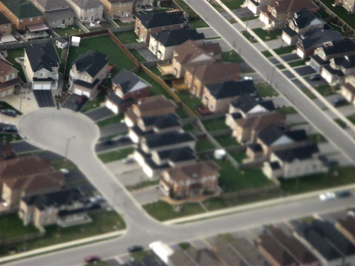
    Case in point: Savannah's utopian, equal-lot ward grid was so successful in Savannah that Savannah did not depart from propagating it to as late as 120 years after its founding! In that tenacity alone, Savannah was very prophetic about the dominant equal-lot pattern of residential land subdivision in America's centuries since. (Sadly, the injunction barring slave ownership did not last as long in Savannah--perhaps a good reason Savannah’s economy never usefully industrialized and diversified from its agrarian dependencies to grow into a harbor-fed metropolis like America’s historic port cities elsewhere on the Eastern seaboard).

    Savannah's Origin tells us that settlers are simply seeking a fair chance at prosperity and the succor of fellow travelers, who, if not always peers in their ambitions, are certainly to be treated as such. The sawyers, the smiths, the millers, and tanners of colonial Savannah created the economic churn of Savannah and they formed the bedrock of a startlingly active civil society (here is where the first orphanage in America was founded – not, may you duly note, in Philadelphia or Boston!). The benefit of not existing alone in the homesteading enterprise, that on your street or in your church or school district is a community of folks of similar life experience – with mutually beneficial talents and skills and philanthropic motivations – actually inspires, sharpens and shores up independent enterprise. This is especially true for pioneering communities. I call this generative drive the “middle class churn”. At its root is an ethos of egalitarianism, a mutually reinforcing social drive, which produces the economic conditions that lifts the boats of all the participants that support and surround it. The labor unit in the egalitarian and liberal context is one which becomes exponentially more generative the better connected and coordinated and socially level people are with one another. This connection does not necessarily imply a personal connection, all it implies is that the services and products it produces can be enjoyed and accessed by more than a select subset of individuals. In fact, the middle class churn is an impersonal drive, to borrow from Adam Smith, an “invisible hand”. The difference between colonial Savannah and today is that the ipod and the networked office cubicle, not the need to farm and homestead, causes us to reciprocate in concert and share information and so create greater value and demand for our products and services.


    Behind the less useful urbanist kind of polemic we often engage in (admittedly myself included) is a disdainful strain that treats the burb as so much blanched snooze-land of conformity thrown up in the landscape. Perhaps, like Savannah, we need to tolerate the condition of “sameness” a little more and poke and prod its squishy surface to see if the filling is not actually more diverse and dynamic than we suppose it or can easily get at with our urbanist forks. We may be judging the book by the cover and dismissing the insight it could offer. Like it or not, our burb-lovin’ North American folk (and Aussies/Kiwis) are the children of the British (humanitarian and pragmatic) Enlightenment. We need to explore and appreciate more the “snooze” condition of suburbia, as Lars Lerup encourages us to. “Snooze”, as Lerup posits it, can refer to the liminal state between dream-land and wakeful activity, where exciting things actually do happen and ideas, actions and new consequences are teased and resourced into being.

    Moreover, the need to mow that lawn and the need to generate a new economic enterprise may actually spring from the very same desire to plug into – not check out of – community. We have underestimated the suburb’s role in tossing the ethnic “salad bowl” in better more generative more socially transcendent ways than we give it credit for. Just try to convince me that your gentrifying urban neighborhood is any less socially stratified and clumped than today’s outer ring communities. Yes, I realize that the “Others” in the urban neighborhood are more physically proximate and commercially connected to each other than in the burb, but, often, this is not represented in actual social terms. What bridges the social distance rather are Lost-like transgressions of social order as well as the connections that are created by the actual concentration of socially active connectors…i.e. real people with trans-communal or humanitarian agendas, which increasingly are just as likely to converge now in the suburb as in the inner city.

    In short, urban planners of America, we need to understand that the greater challenge is inviting that American society (that we have, after all, helped to create) to incorporate better the advantages that small-footprint urbanism could provide it. We need to unplug urbanism to create greater reciprocating investments that increase the returns of the middle class churn. We need to get the smart phone to do exactly what the auto did for the last half-century. That implies for us urban designers a search for forms like Savannah’s, where creating access to opportunity for the greater number of inhabitants is for the benefit of everyone. Where the single-unit enclave is in contact with the open conditions that benefit social/civic identities, urban economic processes (what I call “zoning for the fourth dimension”), civil plurality and social integration.

    Savannah, which was zoned single-family at its outset, is a double-arrowed sign post of where we came from and where we could be headed. Ask not how we can retrofit the suburb, but how urbanism can be emboldened to create a home for our suburban peeps. These are the same people, after all, that made that previous half-century in America the single most outrageous leap, in gross per capita terms, of personal wealth generation that history has ever known (and which, despite our early 21st century bungles, is in the process of scaling out globally now at a colossal and more interesting and more urban form directly as a result of it).

    Thursday, April 15, 2010

    From Savannah to the Burbs: The American Art of Subdivision


    Suburban Surreal, originally uploaded by Ann Douglas.


    An Odonomy of Savannah IV: Origins


    ~ part i ~

    the insight of subdividing


    From the air, the suburban subdivision is a puzzle. If E.T.'s ever came to earth and sized us up, the subdivision would probably first strike them as a bizarre social experiment in utopian egalitarianism. But then they would notice its preponderance across the North American landscape. Looking out of airplane windows, I’m always struck by its almost comical ubiquity. We, however, would argue that a subdivision's denizens pursue nonesuch experiment. How then to explain the penchant to settle in the burbs? Why does the subdivision struggle so heroically to be repetitive...to seemingly synthesize, codify, endlessly erect sameness? Doesn't this seem a little bit at odds with Americans' hedgehog compositions and our open admiration for the rugged nonconformist--the James Dean rebel who has little if any regard for the sized-up Joneses across the street? That cul-de-sac above is a curious form for the land that loved Thoreau and Robert Frost, even if it is literally a road "less traveled by".

    What is this need to create the monocultural clumps of that suburb? Is this tendency to segregate into one's general social strata the fault of pro-forma driven developers that do not like to offer variety? Directly, yes, people buy what they have available to them to buy, and they tend to buy the best of what they can afford. Developers simply deliver the baseline expectations for what Americans expect in a home of a certain price range, and it is convenient for them to knock out those homes assembly line style.

    But would Americans easily purchase that same new home in a subdivision development whose overall pricepoints and socio-economic target demographics varied greatly at the outset? I suspect not. I suspect people would still prefer neighborhoods where their home “fit in”. And I think they do take into careful consideration what kind of neighbors they are going to live around. I don’t know if it is necessarily something wired into the human condition that we prefer our neighbors to look as if they are equally well off (or poor) as ourselves, but obviously the subdivision is a testament to the fact that folks like to be around the kind of people they relate to (even if they never get past “hi”).


    Perhaps we need to unpack this cultural condition more. Savannah shares an interesting characteristic with the typical suburban subdivision. I want to attempt a taxonomy (odonomy) of Savannah's streets in this series, but first I have to puzzle over the question of Savannah's origins, for to fail to see its essential module, the 60' x 90' town lot repeating ad infinitum, is to miss the functionally critical progenitor of Savannah's form.

    Savannah's streets are a consequence of this city's colonial settlement pattern, a grid of town-lot wards that are interlaced with a 7-street order of contiguous streets, creating a cohesive and variegated street fabric that (nonetheless!) was arranged to serve identically sized lots. These town lots were much more size-constrained than the typical homesteading parcels given to settlers elsewhere in the colonies and curiously close to the size and shape of bungalow lots in our prewar suburbs. Even William Penn’s grided plan for Philadelphia assumes a much greater variety of residential parcels, some of its estate lots larger than an entire Savannah ward. Judged by contemporary standards, Savannah’s historic district was at its outset not much different than the typical prewar (grid-type) subdivision often found in our inner ring suburbs.

    Savannah’s fabric of repeating wards of 40 identically sized town lots arose from the need to settle a colony in as fair, attractive, effective and efficient a manner as could be conceived for its purpose (seems familiar, huh?). A single formal syllogism drives Savannah's form: because all the lots are to repeat in size, the wards are to repeat in fashion.

    Source: UGA Hargrett Rare Library Map Collection

    Founded in 1733, Savannah's parcelization schema was a partial solution to the trustees’ desires to establish a Southern colonial economy not predicated on slave labor (you could say Savannah's trustees were early forerunners of the kind of social reformers that spurred the abolitionist movement). Thus, settlers had to be accommodated with homesteading tracts of land, which single families could then independently farm. But Savannah was also a frontier port on land heretofore and precariously claimed by Spain, and the needs of defense required that all families also be able to live in close proximity. So, a tiered land-allotting strategy was devised. Not only were all the settler families to receive identically sized town lots, where their actual homes would be erected, but they were also given rights to equal allotments of 45-acre farm plots in the hinterland south of Savannah. In addition, they were given smaller garden lots of five acres each closer in to the city, in a kind of "greenbelt" phalanx on either side of the common land held directly south of the city.


     Plan of the Forty-Five and Five Acre Lots in the Township of Savannah


    Source: UGA Hargrett Rare Library Map Collection


    Carefully inspecting the arrangement of the 45-acre farm tracts, however, one can discern that they were arranged in a manner to encourage the future formation of hamlets and townships in the countryside, suggesting a fractal strategy of expansion for the entire colonization scheme of Georgia. One must appreciate the trustees’ clever anticipation of the regional diversification of labor over time. As the countryside developed into farming communities, Savannah's trade port economy would allow it to urbanize, allowing more of its residents to sever from field labor as they transitioned to more service, manufacturing and trading occupations over time. Using their town lots as the family business center, this is in fact how Savannah urbanized. Eventually the satellite allotments were anticipated to be parceled out to posterity or to others, as the city expanded and the hamlets urbanized with an influx of colonial migrants. At the outset, however, everyone was encouraged to contribute to the needs of defense (hence the town lot) and cultivation (hence the satellite garden and farm plots).


    Close-up Detail of the Forty-Five and Five Acre Lots Map
    What is noteworthy about all this, especially in accounting for the agrarian based economy of the American colonies, is that Savannah did not socialize or replace (with slave labor) the need to homestead. Rather, it sook a different way to make the cut. In Savannah, the act of subdividing itself represented a generative, economic act (as well as a pragmatic solution and moral imperative). It reconciled the acts of urbanization and agrarian development, which were so awkwardly accounted for in the plans of other colonial settlements, William Penn’s included. It had the insight of the fourth dimension.

    Already at its founding, this arrangement between private allotments, town-garden-farm, set up a north-south commuting pattern, which, to this day, is a functional strength of Savannah’s grid (I’ll discuss how later in a future installment to this Odonomy series).


    I find the trustees’ tripartite subdivision strategy quite inspirational on a number of levels. It is certainly suggestive of applications for sustainable regional planning and urban design today. …The thing that amazes me about Savannah, America’s first equal-lot subdivision, is how many planning insights it never ceases to evoke. In this case, we really should contemplate revisiting one of our starting blocks.


    To be continued...


    (Next week, I’ll discuss Savannah’s conceptual origins and tackle that tricky matter of “equality”.)

    Saturday, October 31, 2009

    Settlers of Catan, TOD Version


    Settlers of Catan, originally uploaded by gadl.
    Every city planner, city politician and professional dealing with economic development should become good at the game of Settlers.

    I began playing the Settlers of Catan in Jerusalem, where a friend, Sharon Alley, introduced us to the game after her trip to northern Europe. Some of my favorite memories include the long hours of play I had among my expat friends in some winter school breaks in Tiberias, overlooking the Galilee. Part of the beauty of the game is the combinatorial board's simplicity, so simple, indeed, that the fact that the instructions and development cards where all written in Danish (or something) somehow did not hamper us much. It was in the play though that things got very interesting quickly. Right from the start, when players take turns placing their pioneering settlements, the game immediately makes Monopoly seem monotonous.

    Thinking back on what motivated me as an architecture student to focus on urban planning, I seriously list the influence of the Settlers of Catan. One reason why my educational tract veered into the Department of Urban Studies + Planning during grad school was the theoretical analogues the game presented me as I studied the roles and interrelationships of transportation, trade, politics and industry in improving urban development and regional competitiveness. By a combination of diplomacy, haggling, and economic resourcefulness, players are forced throughout the game of Settlers to fight for competitive advantages over a simplistic board of resources. This is the only game I know where direct competitors can actually trade game (resource) cards in open negotiation after each dice-roll. (Imagine, for example, what would happen to chess if a player could haggle with his/her opponent to convert a rook to the other side in order to get back his/her queen). This simple and ingenious alteration to the board-gaming norm forces strategies and impromptu alliances to become fluid, crafty and subtle. Some of the dramas of Poker are manifested. Any player of Settlers develops both a an economic resource strategy beholden to the fate of the dice roll as well as a political strategy to deal with his/her opponents. The best players, therefore, can't help but to gain a sense of the underlying politics and economic strategies influencing regional competitiveness in the real world. Part of the value of the game is that it teaches you to think about the resources of cities in systematic, simplified, physical terms while allowing you to see the value of the soft and open social/political dynamics involved that promote development in more non-deterministic terms.

    During my run yesterday, I thought about Settlers as I reflected on my work as a transportation-focused urban designer. (Curiously, as my friends well-know, I was always a Settlers player that favored a road-building strategy over a city-development harvesting/mining focused resource strategy). I suddenly realized that the game could use a rail and transit-oriented development strategy to make it more reflective of the life and health of cities. Here then are my rules for "rail-road" building in Settlers, Transit Oriented Development (TOD) Version:

    All the rules are the same except for the following additions:
    1) A player can upgrade a road link into a rail track by purchasing a second road and laying it next to the existing road link (a "track" is thus two planks side by side). A track counts as two links in determination of links for the "longest road".
    2) A player can't instantly purchase a track. S/he must wait at least one round before upgrading a road link just purchased, and s/he can only upgrade those road links between linked settlements. Players cannot begin to upgrade roads to tracks until the game's first two complete rounds are played.
    3) A player can substitute a sheep resource card for a wood or clay resource card in order to upgrade a road to a "track" (my opinion is that sheep need to become a more useful commodity to a game of Settlers - there's always way too many of them). It is probably best to not allow a player to substitute two sheep cards to upgrade a road link. In other words, you will still need at least one of the road building resource cards to upgrade to a rail track (we don't want to tempt players too much from using sheep to draw development cards).
    4) This is the money rule: Settlements (including cities) connected by tracks allow the settlements to collect resource cards from one another's tiles, as if they shared the same spots on the board. However, only the next adjacent settlement connected by rail can collect from its neighbor's tile. So in the case that three or more settlements are connected by tracks in series, each settlement can only draw from the tiles of its immediately linked neighbor.
    5) No circumventing the Robber allowed. ...A Robber also plunders the train!

    ...Test it out, Settlers playas, and tell me how it works. I believe these rules can serve as a useful analogue to teach your friends about the value of rail.

    The rules above may need adjustment because of the new dynamics it adds. It may be necessary to play Settlers TOD to 12 points (instead of 10) due to the fact that players will be drawing more cards toward the end of the game and you may want more time to have interesting scenarios play out. That's another thing Settlers teaches planners, btw: all things must have their balance and sweet spot. E.g. you want settlements connected by rail, but you don't want that at the expense of drawing development cards. Cities are full of caveats. Codes and planning rules should not over-emphasize one thing at the expense of another thing necessary to the civic life, health and competitiveness of a city.

    Cheers!

    Tuesday, April 21, 2009

    A Visit to Eastern Market in DC


    Wow I'm in the thick of projects. Last night was my first all nighter at work, due to the fact that I spent my weekend in DC. Had to catch up on a rezoning petition! Yes...it's like being back in school. Don't mind at all...I just live for what I do!

    One of my projects is a pro bono project to kick start a local village market in Charlotte...the "West End Market" for West Trade Street. A bunch of enterprising Seversville neighborhood ladies want to start one. So I went to Eastern Market in DC to check out this famous example. I had a great chat with the manager of the Saturday market. I spent so much time out there I actually got sunburned enjoying the thick of DC's magnificent blooming Spring. I also went back Sunday to see the Sunday flea market (when it was overcast) and found many of the same vendors, just a different layout. The original covered market building suffered a major fire a few years ago, and is currently being restored while all the vendors have taken shop on the sidewalks outside, even concurrently to a streetscape project in progress (to be completed in July). Many of the stalls therefore spread out interestingly along the sidewalks and adjacent squares, making me wonder about the possibility of this kind of informal retail to organically spread into the neighborhoods. They should allow these temporary market places to remain, methinks.

    Speaking with Carol, Saturday's market manager (at left speaking to the two gentlemen on scooters), I discovered many interesting aspects of flea market dynamics which have amazing resonance with intelligent urban design. For example, she goes to great pains to make sure that the market layout maximizes divesity of different offerings and takes advantage of pedestrian flow between destinations. The market, which is located midblock on a school parking lot, takes advantage of the fact that it is in a cut through zone between key neighborhood and commercial destinations. Pedestrian flow crossing the school lot through this midblock "shortcut" is therefore subtly managed to entice customers to meander through the shops. In Saturday's market, vendors are allowed to set up their wares and displays next to their vans (creating interesting pod-like layouts), while for Sunday's market they have to park elsewhere and transport all their wares over. Each layout has their own advantage, but what struck me about Saturday's layout was the resonance of the the pod with intelligent block design. Interestingly, the vendors in between the aisles (without an adjacent van as in the market stall above) do the best. Like Charleston's market, market stalls seem to like to be in the middle of the street, with permanent shops and/or "anchor tenants" and food vendors that attract lines on the sides and corners.

    Next on the plate...The Italian Market in Philly? Did I say I love my job? =)