
Insights from Gen. James E. Oglethorpe's Development Plan for Savannah
Part Two
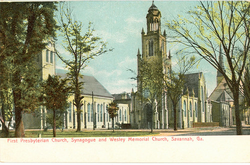 |
| First Presbyterian Church, Synagogue and Wesley Memorial Church, Savannah Ga., originally uploaded by scadspc. |
American frontier settlers were a hardscrabble lot. But, in this trait especially, they were not the self-dependent pioneers we commonly romanticize them to be. They were individualists of spirit, but not of their society. George Jones’s 1734 perspectival drawing of Savannah (see my previous post) is but an early witness to the power of American civic association that Tocqueville would marvel about a century later in his observance of its untrammeled industry. The organization of Georgia’s first colony by Oglethorpe and the Georgia Trustees, indeed, was quite long in strategy to foster effective associations, and quite consciously so.
In Part One, I treated the associations of labor, the work gangs that rapidly boosted the construction activity of the colony by giving it a robust footing for economic exchanges, enabling the colony to immediately benefit from potent forms of labor productivity. Beginning with the guardhouse and fortifications built in the first month, I want to emphasize once again that much of the settlement activity of the colony was created and sustained by public work projects. This was a brilliant stroke for forging a collaborative field of enterprise that creates springboards for private gain and productivity, and it has much to teach us today about an effective form of organizational development: the strategy I called the “Tactical Commons” in my first post. To focus less on the process, and more on the humans, we need to give the catalytic work gang orchestration a better name. To refer directly to the organizational framework, I am going to call it the "Kindling Cooperative", emphasizing here the economic dimension of the arrangement as well as to highlight the instrumental nature of that short-term arrangement, a temporary collectivizing of labor that can, with a few sparks, return a set of common goods and immediate public benefits. The most central and important return is the literal infrastructure needed to sustain the flames - the platform - from which the self-organizing embers of independent enterprise can subsequently emerge. A Kindling Cooperative should at the very least do everything needed to create the platform.
The Two Moral Syndromes
While the Kindling Cooperative represents a short-lived association, it was not the only corporate strategy established at Savannah's colonial start. I briefly touched upon a second lever of association that was longer lasting. Doubtlessly different from these initial work gangs, it comprised the militia units of ten members each called “tythings”. These were something like deputized units whose members were comprised of all the arms bearing men sharing a town block, and who also shared a jurisdictional square-mile tything unit of Savannah’s farm district (more on the latter to follow in future posts).
We hear surprisingly little about these militia units in the correspondence of colonists preserved, despite the fact that the colony’s master plan was anything but quiet about them. Unlike the work life of the colonists, we just don’t see these units coloring the thoughts and reports of the colonists first hand.
Why the tythings were hardly mentioned is hard to tell. Either they were so essential and second nature to quasi-feudal Britons that they did not bother commenting on them in their letters or, as I see hinted, they were rather irrelevant, weak or ineffective associations to these particular colonists. I suspect the latter was at play due partly to the fact that the arms bearing men of the colony were commoners, most of whom were aged well past that age when they might have been more successfully militarized. They are the folks who plied their trades in the commercial centers of London, such as the upholsterer Peter Gordon who I mentioned in the first post, and, as such, they were the kind of folks who very much held a preference for trading-based forms of corporate orientation. The ethos behind this preference is what the urban social theorist Jane Jacobs, in her work Systems of Survival, called the “Commercial Moral Syndrome”.
Generalized across cultures, this “moral syndrome”, according to Jacobs, is comprised by a frame of mind tightly adhering to the following interrelated cluster of values (note: I rephrase or elaborate here and there on her descriptive terms for the sake of immediate relatability):
“Commercial Moral Syndrome” Values:
Shun force, e.g. shun piracy, costly policing, taking without trading
Come to voluntary agreements
Be honest and trustworthy
Collaborate easily with strangers and aliens (cosmopolitanism)
Compete
Respect contracts (versus yielding to privileged status)
Use initiative and enterprise
Be open to inventiveness and novelty
Be efficient
Promote comfort and convenience
Innovate/Disrupt for betterment (“Dissent for the sake of the task”)
Invest for productive purposes
Be industrious
Be thrifty (and quick to the matter)
Be optimistic
These values quite interestingly stand distinctly apart from what Jacobs called the “Guardian Moral Syndrome”, a moral frame adhering to another cluster of interrelated values that are esteemed for certain non-commercial institutional endeavors, typically those based on protecting territorial interests. Religious practices, adjudicating courts in quarterly sessions, and conducting the militia duties are just a few examples of guardian tasks that were conducted by the Savannah colonists. According to Jacobs, basing her insights on the observations of Plato specifically, the cluster of values that comprise the “Guardian Moral Syndrome” is the following:
“Guardian Moral Syndrome” Values:
Shun trading, e.g. avoid bribery, and quid pro quo dereliction of duty
Exert prowess (back up authority with force)
Be obedient and disciplined
Adhere to tradition
Respect hierarchy (and avoid ease in reorganization, unlike businesses)
Be loyal
Take vengeance (back up authority)
Deceive for the sake of the task, e.g. entrap criminals for public safety
Make rich use of leisure and create "art for the sake of art"
Be ostentatious (express ceremony, dignity and continuity)
Dispense largesse (invest in power, influence and control)
Be exclusive
Show fortitude
Be fatalistic
Treasure honor
At first, this dichotomous framework will likely strike you as an odd and sweeping generalization of things. And there's a good reason for that, since today we might initially notice that much of what we would initially consider in the ethos of many kinds of associations today could represent an odd mishmash of all the values above pulled liberally from each syndrome. Certainly, commercial organizations, which Jacobs claimed should operate only with the first set of values, may to us today seem to operate with both sets of values. Today's commercial players, indeed, often do act vengefully and anticompetitively, submit to discipline and dispense largesse and lobby congress members. For instance, today we think of brand value, a core concern for commercial enterprises, almost exclusively in terms of consumer identity, but not that long ago “brand” was more about establishing trust, the confirmation of a promise of value, which relates to the commercial value “be honest and trustworthy”. But this has slanted this way to our contemporaries because a Faustian bargain was struck in the 1950s, and we discovered that the Marlboro Man could displace inconvenient hang-ups. So brands today, as with the “Trump” brand, are more about inculcating loyalty, a guardian prerogative, despite the obvious spin, deflection and tall tales to do so. Branding tactics likewise increasingly use hierarchy and tokens of prowess at the expense of transparency, trustworthiness and adherence to basic market honesty. One can circumvent the need for truth telling and trust setting in a brand by instead appealing to permanent markers of identity.
Jacobs, however, usefully labeled these occurrences of moral blurring in institutions and businesses as the work of “monstrous moral hybrids”. They lead to a lot of social and economic subterfuge, as when police work, a guardian pursuit, bends to questionable moral outcomes when commercial motives sneak in through procedural features (an example is the practice of booking arrestees, sometimes with cooked up entrapment strategies, at the end of one's shift in order to enable the arresting officer to register overtime pay).
Knowing this and thinking carefully through the dichotomous sets of values, Jacobs's framing of them will eventually strike you as quite revelatory. It will change the way you think about organizations in profound ways.
Note, for example, how the values tightly interact within each “syndrome”, yet each set of values, taken point by point, seems to stand in opposition to the other set of values. “Promote comfort and convenience” in the first set stands variously in contrast with “Adhere to tradition” or “Show fortitude” in the second set. Each individual value of the one stands in corresponding contrast with two or three points of the other syndrome. Many of our social and economic malfunctions today boil down to the tensions inherent to the blurring of values, inclinations and tactics between both sets of syndromes when they get mixed in together institutionally. Very interestingly, we can spot these tension points in the correspondence of the Savannah colonists, to come back to our subject.
First of all, the guardian inclination of mind is easily identified in all aspects of Oglethorpe’s activities establishing the Georgia colony. He was a general, of course, and his operational framework for leadership no doubt derived from the military, the guardian institution par excellence. Expressed in his letters through a cool comportment of the narrative details, his motives clearly lean a bit on a paternalistic orientation to the colonial undertaking - namely, his efforts to ensure that civil affairs and matters of defense take precedence over private interests. This often put him in direct conflict with some of the commercially minded colonists.
Several colonists penned letters to some of the governing Trustees relating such instances. One Robert Parker, a miller, airs his grievance to Mr. Hucks, a trustee, regarding Oglethorpe’s confounding strictures to his person. All of his complaints are reactions to Oglethorpe's guardian demands, including the matter of bearing arms for his tything. Evidently, Mr. Parker's sons would fill in for his obligatory watch every fourth night. It is easy to see why the general would regard the matter a dereliction of duty from the standpoint of guardian moral code, as the subbing practice would certainly have quickly undermined discipline and group cohesion and erode ongoing seriousness in the matter. This impasse doesn't seem to even register with Mr. Parker. If it did, his transactional remark that "the duty was never neglected" was in sum all he thought he needed to say about the matter. The main charge of his letter is that these duties could be better addressed through his more productive industry as a mill creator to better serve the colony thus. The trading mindset exactly illustrated.
Another good example of a guardian activity Oglethorpe devised were the marksmanship contests he directed on Sundays to develop the hunting and military skills of the colonists. He would award the best performer with a turkey. Contests, as Jacobs observed, are great opportunities to manifest exertions of prowess and make rich use of leisure time, as well as cultivate group loyalty and bonding.
While held somewhat less prominently in the concerns of colonists, the tythings provided a lever of guardian association that was there - maybe mostly as a formality as the city matured, but a well defined and geographically circumscribed one. This is a defining characteristic Jacobs singled out for guardian work: it is typically oriented toward territorial interests and control. Indeed, the jurisdictional framework Oglethorpe provided for tythings would go on to define jurisdictional geographies, by fact and legal nomenclature, for more than few generations of Savannah’s history.
Congregations and Civil Society
The third lever of association prominent in the daily lives of the first colonists was sustained by the assemblies of faith. The 35 families of the English tradesmen who first landed with Oglethorpe were likely all Anglican. In the summer of 1733, they were joined by 42 Jewish colonists from London who were, except for two of their families, primarily refugees from the Portuguese inquisition who had fled to London. For a time, these comprised the second largest grouping by faith, becoming the founders of the third oldest synagogue in America. Arriving in their number among this second settler wave was a physician who had helped stabilize the colony during a pandemic that blew through the colonies that first summer. Hitting on the heels of Oglethorpe’s first extended absence from the colony, the pandemic had proved deadly, for grifters and insurrectionists had also used Oglethorpe’s departure to their advantage, weakening the colonists with malnutrition, strife and rum-induced delirium as a consequence. Oglethorpe clamped down on the rum trade and noted the effectiveness of the physician’s therapies. He relished the recharge of industry as more settlers trickled in to new province, noting their salubrious contributions to the sober advancement of the colony.
This historical anecdote from Savannah’s foundational year, in retrospect, brings up an instructive attribute about the long-term effects of the Oglethorpe Plan. In particular, it provides a handle for us to think about the the subtle social dynamics set up by a settlement strategy impelling more than one lever of associative order. By grouping colonists into construction gangs and, separately, into militias and obligating them to farm labor as well as periodic judicial assembly, these duties altogether represented both “commercial” and “guardian” endeavors. A cross-associative framework for collective enterprises was set up thus that could neutralize the natural tendency to keep these fields of undertaking otherwise segmented within the tight bounds of trust-communities. With that layered associative order, requiring coordination across all settlement units in the colony, corporate fields of colonial activity could evade the cantonization effects that could have otherwise occurred with the entrance of minority communities. In Trustee Savannah, social life must in daily concourse expand beyond the tacit bounds of trust-communities and, instead, adaptively incorporate a plurality of ethnic-religious orientations within the greater polity of the colony.
This layered cross-association, because it was so particularly circumscribed by the Oglethorpe Plan, allowed a miracle. It created an early path to maintain socio-political stability with the entrance of minority groups. Somehow, in a gingerly balancing act, the cross-associative order managed to nurture faithfulness to one's trust-community while establishing conviviality with the distinct ones of your neighbors in the maintenance of all other colonial associations and enterprises, thereby bypassing the formidable walls of religious and ethnic loyalties. The miracle is that the decision-making sphere actually rests on a homogeneous civic and commercial culture - a civil society - that envelops the entire colony, but it remarkably does not dispense with individual particularity nor cheapen religious affinity. The growing “homogeneity” of daily concourse rests on a plurality of association.
But the miracle goes much further than that. The associative individualism that is a peculiar attribute of American Civil Society has a role throughout the remaining pieces of the Oglethorpe Plan that we have yet to touch upon, especially in its remarkable agricultural strategy, which was aiming to subvert the slave plantation economy. We will pick up on these many things in our future installments, and I shall engage the insights of the philosopher and social anthropologist Ernest Gellner, among others. It will only get more amazing. I hope that you will stick with me.


