Sunday, November 28, 2010

Taliesin West Bakersfield

"Meanie". Originally posted at www.onlinepot.org
Daniel, the always observant (and now well-schooled) follower of urbanist dialogues, sniffs a subtle hankering amongst us landscape urbanists for reverting seriously to Frank Lloyd Wright's Usonian idyll: Is Broadacre City Worth Reviving?.

What Daniel (following Michael Mehaffy) is spotting is the long-standing Hegelian allure for "mashing" agronomy and urbanism as evidenced by American intellectuals hankering for Wright's (Jeffersonian) Usonia.  I would add Corbu's centralized (Hamiltonian) Voisin plan to the list.  While, in the fist-fight between these modernist utopias (or "paradises", as William McClung appropriately calls them),Wright's model apparently proved victorious in the last half-century, Voisin has never really left us either (and, in fact, as Witold Rybczynski points out in Makeshift Metropolis, Wright's own oeuvre did not evade it either).

Might the garden + city movements, in their various ideological camps and manifestations, essentially be a part of the American cultural condition?  Wright's nativist idealism may be an irreducible part of our American mental model for ideal living, as American as cranberry sauce, even if hardly any Americans ever own a pair of overalls.  This much Wright got right about his fellow Americans.  To swing our urbanist scimitars at American Gothic, like Corbu did, would be to alienate us forever from our fellow Americans (Canadians too) and that would do us no good.  We designers then have no choice, essentially, but to shrug our shoulders and try to sublimate it.
 
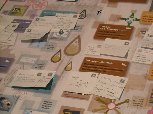
Full disclosure: I am myself a product of the academy, which, though we never claim it outright, holds the movement towards a landscape urbanism, or landscape +  urbanism, if you will, with a venerable light not reserved for New Urbanism.  Vehemently so.  But, at least I will admit here that my love for landscape+city+semiotics is essentially a romantic one (er..., blushing evidence here and here).  I am, yes, aware that the way we use landscape (for recreation, ecological regeneration, or agriculture) is primarily a cultural question that the designer can engage (and perhaps influence) but never quite control. All design, let's face it, is a utopia.  The reason that landscape urbanism appeals to us urban designer types is the way it engages the fourth dimension in the planning challenge, in pointing us to the ecological and changing conditions of the city. It is a relaxed and appealing view of urbanism. Sometimes, it too loses track of society and reality and economics, but that's design.  That's life in fact.

While I don't consider Wright's "democracy in overalls" essentially realistic, I have always admired how robust and undiluted in spirit Wright's infrastructural vision was.  People seem to miss this subtle attribute of Usonia.  I would like them to squint more carefully at the models and notice that Wright's Usonian roads, bridges, and ramps are nothing like the flimsy and dispersed and decapitated infrastructure of today's suburb.  The suburb has never replicated the soaring infrastructural heart of Usonia, grided and resilient and direct and exorbitantly expensive as it was relative to what it served.  This is not the amorphous and flimsy and branched infrastructure of today's suburb.  That is the constant mistake of urbanist paradises: to essentially get the economics wrong at the outset.  They always have to transmogrify to lesser versions of themselves.  Simply, Usonia can not support that kind of dispersed infrastructure with an agricultural-based economy of one acre per farmer.  Wright's Usonia was never replicated because it made no industrial sense whatsoever.  It did not scale.  The problem with landscape/agronomic urbanism since Wright and Corbu has always been that sticky implementation piece.  Van Valkenburgh's wilderness in the wharf and New Urbanism's Serenbe, GA are sort of our alternative responses to this problem.  One focuses on implementation with high-stakes public projects and one takes advantage of Americans' market preference to seek out a quietude in (essentially suburban or small town) community life.  Both of these responses seem somewhat limited and situated and ineffectual blips.  But what is the alternative?  How else do you support agriculture at an industrial scale in the urban fabric that makes sense?  What is the soft (social and market) infrastructure that you need?   

So, while I'm at it, let me point out one place where I do see Jeffersonian Usonia as feasible in an industrial scale. That is in the anti-federalist pot-growing communities that are now forming in the edges of urbanized California. Essentially, what you have in Cali is a great condition for a great resurgence in a "democracy in overalls" which actually gives economic incentives for agronomic production with small-scale farms.  Watch, oh fearful planner, what happens when Cali eventually adopts the "100 square feet" per grower rule.  Suddenly, you have the economic leverage you need for single families to buy up those foreclosed homes in the Valley's grided landscape, which seems ready-made for the spirited Usonian infrastructure of Wright's vision.  Taliesin West Bakersfield!

Friday, November 19, 2010

The Joy of Biking DC

Bike share station in DC's Eastern Market
I spent much of my Halloween weekend in DC on a bike.  I was in DC to run the Marine Corps Marathon on Halloween, my first time ever attempting 26.2 miles, but on the days leading up to the race, I couldn't stop myself from punching it down those DC avenues on my rental, swerving from from one multi-lane avenue to another.  Pedaling around our capital city was an exhilarating experience.  Yes, my virgin marathon began with a little bit of telltale tightness in my hams, but it was worth it. (Yes...I finished the marathon.  The whole experience running MCM was thrilling...It certainly will not be my last 26.2!)
Surprisingly lucid thinking in DC

Short and sweet though my time was, I have now run and biked the District enough to become convinced that DC just might be the perfect city for both activities.  It is also the perfect city for rallying, which I did (along with the sign-bearer at right) that Saturday at Jon Stewart's Rally to Restore Sanity. That's an aspect of DC's virtues that requires travel of that more noumenal variety (the kind that tends to gum up Proper Scale enough), so I'll avoid it for now.

As for biking, never before have I traveled so happily down trafficky streets and avenues.  The thought dawned on me quite fast that this was not my typical urban biking experience.  I had to pause a moment to ponder about what made DC feel so different...

Pennsylvania Avenue
Was it the wide avenues?  Perhaps the generous amount of pavement everywhere in the District allows enough traffic slack to grant the cyclist some breaks to get in and out of traffic lanes easily, but (with the exception of Pennsylvania Ave. at left) you take your life into your own hands down many of these.  Let's put it this way, you need to be comfortable with clearances just inches between yourself and moving vehicles.  The thing that made a positive difference in my experience getting around on a bike in DC, as compared to my experience in Boston and Jerusalem, is hard to tag (in Charlotte, people, I don't even try). But this I noticed was something I appreciated about DC's Avenues: they run enough interference on faster traffic (due to congestion produced by plentiful merging points and intersections) to keep traffic at an even keel and closer to cycling speeds, while at the same time offering longer stretches of uninterrupted travel, which make both cyclists and drivers happy.  For cyclists, stops are just as annoying as for drivers in the grid; in fact, even more so, since having to stop at an intersection means breaking your hard-gained momentum, which is what allows you to stay at travel speeds matching the traffic alongside you.  Staying at these higher speeds allows you to safely share the road with vehicles, and, in fact, take command of a lane when necessary.  These kind of sharable arteries, with highly pedestrianized urban street fronts, are rare here in the States.  But DC is thick with them!  Because they are everywhere, traffic tends to be evenly distributed.  Even if they mess with your sense of orientation, these wide streets have a certain predictable pace, almost a kind of ordered, lolling behavior, that the cyclist picks up on intuitively and can use to his or her advantage. 

Approaching Eastern Market
Was there a difference also in the amenities?  That signature bikeway on Pennsylvania Avenue is a joy to ride down, certainly.  Some of the world-class city offerings, including the Capital Bikeshare program, were there, and I am sure these do much to encourage bike travel in DC. The bikeway network, on the other hand, was the limited-run variety rather than the comprehensive kind.  But I noticed that the bike lanes that do exist are actually necessary and do go a long way to make a difference, especially when they are actually needed to create some clearance for the cyclist to bypass backed up traffic, therefore granting the bike mode a coveted edge (and also allowing the cyclist to stay off the sidewalks to bypass such conditions).  Some of these lanes, as in the busy narrow streets in the Eastern Market area, make very obvious why bike travel in DC has long gained the favored mode status for many locals.

While planners like me riding around DC might quibble that the bike lane network is patchwork at best, I would say that not all the conveniences and provisions for bike travel across greater distances in the city are really needed.  Sure, judged by mere infrastructural capacity, DC's travel split on the surface is still skewed heavily toward the automobile.  As the images on the blogosphere today betray, New York today and, certainly, Portland are doing somersaults over our capital on this score. But DC has a whole lot of other pluses and lessons for improving bike travel.  Some of these may even obviate the need for the white stripes and pavement dedications.

A very sane cyclist observes an outdoor performance of the Pirates of Penzance unfolding at Eastern Market

Of course, the key ingredient making DC special is L'Enfant's grid.  It is, to be brief, a difference of amenity inherent to city form. When it comes to biking, city form is the first thing bike-supportive planning should think carefully about. Too few of us spend time thinking about it, although we deal with it implicitly if not directly in design.  When you are working with the right fabric, maybe you don't need the Portlandian exuberance with bikeway infrastructure.  DC seems to teach that maybe these solutions should be implemented only when they are actually necessary.

After a couple weeks mulling over my experience, I have slowly come to the realization that, in fact, L'Enfant's grid just might be peerless in its advantages for integrating multi-modal transportation effectively in heavily traveled districts ("might be peerless" ....I'm not yet ready to claim it outright, though I'm tempted).  The advantages that make bike travel special in DC are also the same advantages that make travel of all other modes there effective.  L'Enfant did DC a huge favor not only in giving the heart of DC wide, Parisian-style rights-of-way but in designing radial avenues that lace across DC's grid diagonally with respect to the rectilinear infill grid, giving DC plenty of what I call (as I've modified for my private odonomy on this blog) "Grand Avenues".   Grand Avenues help everyone.  They help motorists, cyclists, pedestrians, buses and even the underground subways with stations leading out to them (I'll explain why later).  Even when the pavement stops, Grand Avenues may still continue for pedestrians (such as across the rolling lawn of Capitol Hill for the pedestrians headed from the Eastern Market area to the Rally to Restore Sanity at right).  A city's Grand Avenues, it seems, get inside the heads of its citizens.  They seem to amplify the pulse and vitality of the city with what they connect.

Bike parking at our national public forum
DC, unlike every American city I know, splits traffic flow with avenues (instead of simply channelizing it to them).  It disperses and modulates traffic flows enough to make wide surface streets sharable between cyclists and vehicles.  All those skewed intersections simply multiply travel options.  In the cases where it doesn't, and the traffic is simply too thick and relentless to allow the cyclist the direct route option, the cyclist often has the option to navigate quieter local streets that circumvent the artery traffic. 

Previously, the precedents presented by places like Copenhagen and Portland led me to believe that the urban design challenge was to find ways to claim more pavement for the bike.  But DC seems to have taken the opposite tact, brazenly maximizing surface provisions for the automobile instead.  With all its rights-of-way, L'Enfant's city seems to have passed a sweet spot.  Instead of corralling and flagellating it, avenues here seem to placate traffic behavior, letting it switch often and lead more directly to its destinations. Sure, radial avenues intersecting at odd angles with the grid insert even more intersections than needed into it (maybe these serve a good purpose we're not appreciating?), and often these are the skewed kind of intersections that imagination challenged DOT's detest (and don't allow you to design, that's for sure!).  But, ...I rode a bike in DC, and I can't remember the last time I had as much fun on a bike...

Sunday, October 24, 2010

When you are this far from Jaffa Gate, all one can do is post love letters...

Photo by Ira Lippke
Ismael writes again.  Periodically my Palestinian friend Ismael, Jaffa Gate's bard and genuine Professor of Peace to the visitors of Jerusalem and the peoples of the world, updates his plea to rejoin him in Jerusalem. His emails are always piercingly terse, warm little notes of heartfelt expectation:

How are you I hop you are doing will, ..., i send you the translation of "bride and mistress of cities jerusalem" in arabic i wish you fo publish it so the people can find it on google.
in holand an old man "75 years old" he make a music and they sing it.
now we are doing a music to sing it in arabic.
hop to see you soon in jerusalem
I love you, your Bro Ismael.

Heaps of love back at you habibi!  First of all, I'm flattered (though skeptical) that anyone could think my blog is a portal to feed the Google bots.  But on behalf of a worthy author, I will not expend any effort in diffident dawdling and trepidation to get this baby out there. I'm happy to oblige, dear friend...

I'm most glad to post this in its original, unadulterated form, knowing that the authors of Ismael's Arabic-English dictionary are probably fans of late-18th century British Literature.   Not that the intriguing English translation is not without its merits, but one suspects a little work is needed to contemporize things a bit. Unfortunately, I don't know Arabic to be able to contribute my thoughts usefully for a modern English translation.  (Maybe any Arabic readers out there can help us out.)  But I can read just barely enough to see that the poem Ismael sent is more expressive, unabridged and heartfelt.  Here is "The Bride and Mistress of Cities...Jerusalem" as penned by Ismael Obydat in its original language...


عروس المدائن...يا قدس
سيده المدائن...ياقدس
بين التلال تزهو في بهاء
سماوي ودلال
عروسا تزينت بنجوم السماء
باركها العلي...وشرفها الأ نبياء

الله اكبر    الله اكبر   الله اكبر   الله اكبر
باسمها تشدوا البلابل في الصباح
وعلى أسوارها يهدل الحمام
وفي المساء يغفوا الحمام
وبين أحضانها تغفوا الأطفال

تتحد روحي مع روحك
كما يتحد النور بالنور...فلا ظلام
وكما يتحد الماء بالماء...فلا عطش
لا الموت يقدر أن يفرقنا
ولا أحد يقدر أن يقتل حبنا
تباهي وازدادي دلالا وشموخا
ياقدس ...يامدينه الضياء
أسري بروحي اليك
بالحب ازرعها فتنمو وتزهر حين تراها العيون
تسبقني قدماي الي أبوابك كل يوم
أحلق عاليا...بعيدا...بعيدا...مع النسيم
تأخذني رائحه البخور...رائحه العطور
في الأسواق...في الساحات...وفي كل فناء

أعتلي الشرفات التي تلوح لي برايات النصر
تلوح لي برايات السلام
تلوح لي برايات المحبة و الهناء
وكما تحمل الروح بذور الحب اليك تزرعها
احمل روحي  معها...أزرعها
فتنمو فتزهر بالحب حين تراها العيون

اقبل وشمس الصباح
كل شبر من أراضيك
ومع بدر المساء أهمس حبي بعشق أناجيك
بحبك أنا ملك وأنت مليكتي و مليكه  القلوب في كل مكان
يا قدس عهدا سأبقى على حبك...يا قدس
فحبك خالد
حين يذهب كل شئ...كل شئ الى فناء
تباهي وازدادي دلالاً
يا عروس المدائن...يا سيدة المدائن
يا مدينة الأنبياء... يا مدينه الا سراء يا مدينه الضياء

اسماعيل عبيدات
استاذ باحث في علم الاجتماع
موبايل0525420473

Thursday, October 21, 2010

Brat Pack Urbanism

Molly Ringwald in John Hughes's Pretty in Pink. From avoidantconsumer's Brat Pack mashup


Coming to a city near you. Brat packs around the world appear to be taking to the rooftops, bridges and streets of their cities to put their spin on the "Lisztomania" dancing-mania viral challenge.

It started when a group of Brooklyn hipsters shot themselves dancing on a Brooklyn rooftop to Phoenix's Lisztomania:


I first saw the "Brooklyn Brat Pack" video via a link by Cerre, who came across it on a Craigslist ad for a Brooklyn apartment. I don't know if it was the urban waterfront and scripted dancing, but the video made me very wistful for my early-90's undergrad days in Boston when I myself first became an urbanite. So I tagged the video in my faves.  I noticed then that a group of SF kids had also imitated the video. I thought it was kind of geeky of SF youth....not wanting to be out-hipstered, of course, but I noted the way the production lovingly profiled the city:


Phoenix - Lisztomania (SF BRAT PACK MASH UP) from chinorockwell on Vimeo.


That was it. I knew that we were on to something viral here. Sure enough, coming back to check later, here are a few other entrants to the Lisztomania bobo-city challenge:

Amsterdam:


Winnipeg:


Rio:


Riga:


And hey...Boston. If there ever was a Brat Pack U, it's gotta be BU:


As you can see, some are rather slickly produced, others more "carefree".

I didn't infer early on that the "Brat Pack" in the Brooklyn video title was a reference to the memorable dancing scenes in 80's John Hughes flicks, so I was a bit disappointed when I discovered that the original rooftop dancing was all choreographed to roughly imitate the dance sequence in avoidantconsumer's Brat Pack tribute (currently found here), which features the dancing highlights from the Breakfast Club and Pretty in Pink,...with a smidgen of Mannequin's(?) thrown in. The dancing revelry in all the above renditions is quite genuine and delightfully city-scaped, but, so far, none of the dancers I notice seem to have captured the utter abandon of the original references. The unloosed ecstasy of Jon Cryer and Anthony Michael Hall. And the undeterred expressions of Molly Ringwald (perfect example above), which in their aped versions I kind of mistakenly thought were sweet and artful montages. (C'mon, do our census-snuffing bourgeois youth have to be blase even in this?) 

But,...then did I fully grasp that undercurrent of nostalgia striking me subconsciously. There was nothing necessarily "urban" in the pop-saturated angst-paraphernalia and upstart don't-hand-me-down attitudes of the Breakfast Club, but we, the kids of the Boomers who were weaned on this stuff, sure brought the mantle of Brat Pack couture into the city in the 90's. I remember Urban Outfitters back when it was just another thriftster dive in Harvard Square.  We turned the city into our urban lab and accidentally created the condo-boom of the early Ought-as. To see these dancing Millennials fooling around on our prized rooftops is both endearing and upsetting, lets face it. Envy-producing. It brings poignant waves of reflection, especially as many of us, with mates and babes now in tow, face the prospect of heading back grudgingly to the burbs, to the wastelands and old haunts of that vacant consumer culture we thought we spurned.

Life moves a full circle. It's hard sometimes to see that so it can be with urbanism. That the "choice" of urbanism is as banal as a tolerance for sharing flats with Friends. What was our love for the city, really? A passing fancy? A sinister fetish? A dance on the rooftop with the fortunate only?...Sentimental, no, not sentimental. Romantic and disgusting. From the mess to the masses...

Sunday, October 17, 2010

A Savannah in the Desert?

There's Flickr, and then there's Mesa #9

An Odonomy of Savannah VII: A Tale of Two Grids

~ part ii ~
inertness and porosity

Of all the random, visually interesting development patterns I've stumbled across on Google Maps, the trailer/RV parks of Mesa, Arizona sure compose some intriguing aerial ruminations. Unlike the garden a la francaise interests that sometimes appear in aerial photos of suburban subdivisions, what strikes me most about Mesa's patterns are the rectilinear and simple geometries they playfully vary in Mesa's half-mile arterial grid fabric. Here are examples of what I mean:


The brutally efficient compactness of these trailer park patterns, jiggling and permuting different ways within their self-absorbed perimeters, makes one's eye squint a bit at the optical glare produced. Indeed, the bright roofs of the densely packed units are a noticeable feature of Mesa from earth orbit. The bright band in the center of the Mesa area aerial below represents these trailer parks from on high, which are abutting Mesa's Main Street/Apache Trail east-west artery, cutting right between a contrastive greenish swath of sprinkler-squirting Arizona subdivisions:


One can't help to wonder if these trailer parks reflect a lot of solar radiation away from the Phoenix area, and one even suspects a collective recoup here of sorts in lieu of Mesa's heat-island contribution to net global-warming impact. I wouldn't even be surprised if they also help make up for that indeterminate bit of glacial retraction and polar snowmelt that Mesa's emissions produce.

Regardless, I, of course, can't help but to notice the formal similarity between these developments and a Savannah Ward.

Here, for example, is a typical Mesa/Apache Junction trailer park development:


Compare with a (more residentially comprised) Savannah Ward...


For the heck of it, here are other variants of Mesa's trailer parks:


In the above examples, notice that the community/leasing complex usually in the smack center of the development appears as a staple Mesa trailer park amenity. Notice also the way the main drive of the development ties head-on to the complex, much like Savannah's signature north-south streets that lead directly (and encircle) the garden squares. Moreover, these entrance drives tend not to be loading streets, but what I define as "avenue" types that channel travelers directly (and sometimes ceremoniously) to destination points as their predominant function. Of course, the Mesa developments are much larger than a Savannah Ward, up to six times in size even, but the shared community amenity is, very interestingly, roughly the size of a Savannah garden square.

What's most interesting to me about the above comparison, however, is the near similarity in dimensions between Savannah's original town lots, which vary slightly more or less than 60'-0" by 90'-0", and a typical Mesa trailer lot, usually sized around 55'-0" by 80'-0". In some locations, Mesa's developments even have what appear to be woonerf-like open, semi-shared "backyard" spaces in the block interiors (between the rows of mobiles), a tantalizing equivalent to Savannah's intimate residential service alleys. While it, of course, developed more densely and compactly over time, Savannah's present form has evolved out of town lots just a little bit bigger than these Mesa trailer lots. In fact, in some of the more residential squares, Savannah's lots have subdivided further into lots much smaller than the trailer lots, but in a hardly noticeable manner. It's hard to imagine that two or three stately Savannah Victorians can fit in an area not very much larger than a Mesa trailer lot, but they do...and this they do in Savannah with a kind of quiet, comfortable manner that brings added intimacy to their street-setting:


The three detached Victorians on the left share what was originally a single 60' x 100' Savannah town lot

All this begs the intriguing question, could Mesa evolve over time into a kind of "desert" version of Savannah?  Well, if you just glance at the image of a Mesa trailer park by Flickr poster kevindooley (at the top of this post), one can easily begin to imagine suggestive possibilities for a desert-scaped woonerf.  (Why, my landscape urbanists out there in AZ, just turn that couch into a Diller Scofidio park bench and you're already 50% of the way there!)  Unfortunately, the challenges for such a transformation are more daunting than that, of course.  Which brings me back to a critical asset of Savannah's "Two Grids".

I mentioned in part i that Savannah has two literal overlapping grids.  One primary grid handles most of the vehicular traffic work-load, and serves as Savannah's equivalent for Mesa's half-mile segmented arterial grid.  But the other grid of Savannah, which handles the local traffic and much of the ped/bike movement, is not just a discontinuous local/collector/service network but, in great distinction with Mesa, is a true grid, which holds its own integrity from ward to ward.  Savannah's contiguous secondary grid is the unique asset of its form, a profound quality of Savannah's form worth interrogating and experimenting with in our form investigations for cities.  The two-grid system synthesizes Savannah's economic diversity to the very specific circumstances of its public realm and harmonizes its transformations.  

In part i, I went so far as to claim that Savannah's fabric is "open" in its synthetic function, in that uses and their interrelationships are not pre-determinately set or stiffly delimited and are seemingly allowed to transform over time, in distinction to top-heavy and ready city planning approaches. But, I'm realizing "open" might be a bit of a misleading term, and misapplying the takeaway, if one interprets this modifier as "randomizing" or politically-neutering the act of development or, even more, as contemplating some theory of libertarianism.  Rather, I dealt at length in that post with exactly the more mundane and determinate exertions of Savannah's form on land use and transportation decisions in Savannah.  The truth is, Savannah's form must be socially negotiated continuously, as all inhabitants must in every city, but, what is somewhat novel, is exactly how Savannah's system-like form "tunes" and harmonizes these negotiations.  Form and negotiation travel here hand-in-hand in a noticeable way, and both build upon each other.  They make Savannah's invisible "rules" of city transformation legible to the historically reflective eye.  Today, however, Savannah's form has closed like a trapdoor on itself, at least to conditions of transformation in our time scales of experience.  Historical preservation priorities have reinforced this.  A harmonized stasis it might be, but a stasis nonetheless for our present-day vantages of development.  In this respect, we may look with interest at Mesa's potential to urbanize.

Unfortunately, Mesa's discombobulated collector/local/service street fabric exerts a dubious influence on its potential for Savannah-like urbanization.  These small-lot trailer park conurbations are not likely to see any evolutionary development along the lines of Savannah's historical trajectory (even if these fabrics made urbanistic sense - which they don't, really, but I won't treat that topic in depth now). Simply, Mesa's private street networks only serve the abutting users of the street; they do not avail themselves to the greater traffic of the city. This is by no means a trivial distinction. Not only that, but these developments often have a single and highly controlled point of entry, their sole link to the primary grid.   They might as well be gated entry, conventional garden apartment developments, and their only likely fate is to be likewise redeveloped wholesale once their conditions of deterioration become unbearable.

In Savannah, small-grain local negotiations produced gradual urbanization and gave birth to land use diversity, but Mesa's single-use developments and disconnected private fabrics transform only with transactions involving what Jane Jacobs called "cataclysmic money": upon the decisions of leveraged landholders somewhat removed from any slow-forming communities that they might impact.   Savannah's land use diversity evolved under conditions of "porosity" both of travel and of capital flows, catering to locally modulated conditions of access, adjacency and travel pattern in ways that guaranteed that local investments would need to weather the test of time.  But such conditions are not permissible in a Mesa trailer park, both due to the lack of its users' agency in land-investment decisions and their sole dependence on vehicular links to employment and consumption resources that lie outside of the development.  Their money, whose source is more than likely from the outside, likewise travels only in one direction: outside.  It cannot be invested within except to be immediately consumed or parked there intermittently on wheels.  Their interests (and hopes) lie elsewhere.  Their TV's and iphones guarantee it.  Mesa, simply, has too much flux within and without and the inert edges between inside and outside are its most stable condition.

What would happen if this street had more cross connections?...

View Larger Map


Might intermittent residency, economic disadvantage, social powerlessness and isolation continue to haunt Mesa's trailer parks? Might they see their trailer lots become individually owned investment assets? Might they connect their wealthy, land invested neighbors to the north and south of them in interesting ways to create the ripe connections needed for urbanizing Mesa's "Main Street" from a drive of strip centers to vital centers that can also concentrate social capital?

What are the inert conditions that are responsible for this?...


Mesa's Crime Rate Map ...Not just bright from space.

Monday, October 11, 2010

Of Unconferences, Incubators and Worlds

What has Google cached?Yesterday, I attended Charlotte's fourth Barcamp at Area Fifteen.  Area Fifteen is a former industrial space re-purposed ad hoc to serve a bevy of small businesses.  Of the ones I know about, these outfits include a bicycle re-cyclery, office spaces for small businesses, a dance studio, a concrete furnishings workshop, a "free store", a barista training center, a prayer room, a coffee shop, a jewelry/accessory storefront, a massage/tea blending happiness center, artist spaces, Jared's rabbit hole and ...who really knows what else?  Located throughout the complex are many break out areas and assembly spaces, including decks and transition areas/docks, with a large side yard for event parking, outdoor art markets/gatherings and a vegetable garden.  There's something about the loose organizational structure of Area Fifteen that lends itself very well to the equally loose, ready-to-mix ethos of a Barcamp "unconference".  The fact that Area Fifteen has enough leftover space within it to host a random gathering of geeksters and entreprenuers says quite a lot about the virtues of this place.

new CLT Blog space at Area 15In don't think these sorts of venues can exist without a ready-to-use informality to them that suggest an atmosphere of easy adaptability and freedom.  The sheer diversity of users and rapid turnover of activities always amazes me about Area Fifteen.  I expect the place to be literally different every time I step inside.  Area Fifteen, of course, is an "incubator space" of sorts, except without much of the pretension.  Some activities prosper there for profit, others for not.  Characters come and go.  Some uses flop and others, becoming resilient, grow and move out to bigger and better things, much as Jane Jacobs observed some 50 years ago about the tendency of Brooklyn's small industrial flex-spaces to spin out ventures to the suburbs.

Members of Area15 are introduced at one of the Barcamps
But Area Fifteen, like Barcamp itself, is a resource for a community.  Both can be launching pads or catapults.  Area15's mission uses adaptable space resources, Barcamp's emphasizes ready-to-share, moment relevant information that a community values - particularly, concepts and topics that are just percolating from the bottom of coding/media industries - adaptable knowledge resources.  Unlike the community resource that Jacobs observed was disappearing from Brooklyn in favor of the suburbs, Area15 and Barcamp seem to have found a way to catalyze on a draw back to a community.  I realized at this Barcamp that the success of these entities is not predicated on their ability to launch "start-ups", but in their ability to create launching communities - pockets of people with common interests that do often share and leverage each other's resources and talents.

There was an insight here about approach.  What is the resource?  Compare the gregarious workspace of Area 15 with the acres of mostly vacant air-conditioned carpet at your local convention center.  Conventions are useful and nice, and pretty darn expensive to run and attend.  But what is the return on their value really?  I would say that the horizon for your industry is rather limited if you depend on conventions to tell you what's next. I mean, just a thought. You're not really at a convention to integrate what's new, but to kind of participate in, well, conventional adoption.  People go to Barcamp to find out why conventional wisdom is wrong.  The claim of one session at Barcamp was that volume of (automated!) posting can catapult your presence on Twitterspace. Which led to some interesting discussions.  You're not at a barcamp to find out  how you are falling short of next-wave normal. You're at a barcamp to "network", but the kind of networking that is a heat-seeking learning process, testing the idea space, hopefully leading you to bump into others who can help you move an idea. I would argue that it is these kinds of situated, local connections made in a ripe time and place that bring sparks to a city's industries.  


It got me back to thinking about the world-scenario ingredients of the Institute for the Future's 2010 Map of the Decade. In Aesop's parable of the  Oak and the Reed, a strong wind uproots a rigid tree, but a reed, being able to bend in the wind, survives. One lesson: The mighty are usually not very adaptive. 
The IFTF four world-scenarios (briefly described in my last post) are presenting four points on a conceptual two-item sliding scale of world-future possibilities.  This single-contrastive line is traveling along an imaginary axis measuring the extent of organizational adaptation/innovation under different global realities and constraints. Toward the one end of the sliding scale are worlds that see relatively little organizational adaption that lead to fundamental changes in infrastructural systems. These are the Growth and Collapse scenarios. These are the Oak worlds.  The Growth world sees progress as conventional growth - the bigger the oak the better, and the Collapse scenario is that tree uprooted by the storm.  On the other end are worlds that employ fundamental changes to the extent that they are able to - these are the Constraint and Transformation scenarios.  Both of these worlds allow "reeds" of progress to adapt to uncertain conditions.  In the case of the Transformation scenario, circumventing institutional, oak-ways of doing things is de rigueur. 

It is easy to argue that the Transformation scenario is the one furthest along the process of infrastructural restructuring (or at least has the greatest capacity for such).  The Constraint scenario is undergoing some fundamental restructuring due to its institutional refocus on ledgers assessing "Gross National Happiness", but, in a low-capital world, it has less investment capacity and broad cross-organizational ability to employ wholesale and unfamiliar infrastructural changes (what the IFTF calls "superstructuring").


Here is the thing I notice about the denizens of Area 15 and barcamps ...the people there are the sort that sniff for the kind of changes and "reed" models that lead to fundamentally new ways of doing and valuing things.  Growth constructs lead to convention center ways of approaching industries, effective while the wind behaves, but Area Fifteens are where I suspect our next decade's reeds will sprout.

Tuesday, October 5, 2010

What will the Next Decade look like? Some fun with Scenario Mapping


    MOTD Game BoardI recently came across the 2010 Map of the Decade, created by Silicon Valley's Institute for the Future (IFTF), and I have lately been having fun with forecasting and scenario mapping.  IFTF is a non-profit think tank that forecasts/evaluates the new social and infrastructural transformations impacting global forces.  The Map of the Decade project is part of the IFTF's Ten-Year Forecast Program, which hosts a yearly "game event" for collective prognostication among social tech folks, marketing futurists and the like.  This year's map is an intriguing (game-board like) table for conversationally imagining the transformations in key areas of human activity that are likely to emerge over the next ten years.

    I am blessed by my friends, but, well, they are not nearly as geeky as me.  So it is highly unlikely that I may find willing volunteers who would join me to play the IFTF's forecasting "game", but ...I enjoy nonetheless thinking about the construction of this alternative reality table.  The game's contrastive scenario mapping presents to me one of those engrossing random occasions where interesting topics from my MITSAP studies envisioning the city intersect with my interests in ancient rhetorical devices.  The deep past and next decade collided here.  ...But, I may have to get to that part later.  For now, let me just explain this simple but intriguing "gameboard". 

    The table synoptically maps the structural transformations of five forces in four alternative world-scenarios.  The columns of the table represent the five forces that will emerge - or undergo some extent of structural transformation - in the coming years, which the IFTF dubs: (1) the Carbon Economy; (2) the Water Ecology; (3) Adaptive (Political) Power; (4) Cities in Transition; and (5) (Social/Personal) Molecular Identity.  (Parenthetical modifiers mine). The rows of the table represent the four contrastive world-scenarios in which these transformations could play out.  The world scenarios represent four different trajectories of global economic, environmental and political circumstances that the world could progress into as we travel the next decade. They are:

    • A Scenario of Growth, "Staying One Step ahead of Disaster" -- This is a world-scenario in which the current "growth paradigms" of the global economy continue to be the measure of personal and national success, but where infrastructural adjustments basically attempt to just plug the leaks in our Gaya bucket.  In this world, political activity tends to shore up national self-interests.  Investment is motivated by crisis management.  Instead of encouraging a fundamental restructuring of a wide variety of human activities, knowledge resources remain uncoordinated, and current societal circumstances (e.g. increasing income disparities) continue in their present trajectories.
    • A Scenario of Collapse, "Local Disaster, Regional Conflicts" -- This is a world-scenario in which local instabilities lead to widespread regional conflict and societal upheaval, sparking mass migrations.  The de-legitimization of institutions "signals the end of the globalization era". In this world, political activity is opaque and distrustful. But, as cities go "feral", some local-system restructuring takes place at the small-grain scale as communities adapt to new circumstances (e.g. the coalescence of urban farming communities).
    • A Scenario of Constraint, "Sustainable Paths in a Low-Capital World" -- This is a world-scenario in which the current wealth-production paradigms of the global economy can no longer be sustained.  Instead, national and personal happiness is measured in non-monetary terms. In this peer-measuring LEED version of the world, lessening one's carbon/water footprint is the path to success.  Infrastructural adjustments are policy based and draw on participatory self-monitoring strategies.  In this world, political activity is policy-focused and concentrates on the scientific management of resources.
    • A Scenario of Transformation, "Superstructured Systems" -- In this world-scenario, the barriers preventing wholesale restructuring of human activities are removed as new paradigms of organizational/social coordination arise (employing neural innovations for one).  Conventional institutional paradigms of management are quickly outmoded (much as the cell phone has outmoded the need for erecting land-lines in developing countries, for example).  Rapid innovation leads to biomimetic technologies and ecological infrastructures, enabling human colonization of the oceans and harsh environments. All aspects of human activity, including politics, are approached (or circumvented) through diffuse and cross-disciplinary activities.  In this world, integration is the norm as new frames to approach systems draw to the surface and become widely engaged in a highly networked world.  This is a world of wholesale "superstructuring" of basic human activities into novel forms.  Think World 2.0.

    MOTD Game BoardFor a force transformation item isolated in each square of the world-scenario grid, players of the game are asked to imagine how "happiness" and systems of "resilience" are created within that transformation, and how interventions could leave a "legacy" our posterity would value .  "Happiness", "resilience" and "legacy", however, must employ the evaluative paradigms of social value and self-identity extrapolated for that potential world, which is a kind of role-playing turn which puts the fun into this exercise of wonkery.

    The really fun part for me is that the game naturally leads you to ponder the spring points impacting important arenas of human activity, from the wholesale to the particular, in a wider matrix of possibilities that expand imaginative outcomes and lead to a better way to grasp the transforming subjects themselves.

    More on that later.

    MOTD Game BoardFor now, let me just say that in the Southeast, this whole "Water Ecology" business is a force indeed to be reckoned with.  Over the next ten years it will increasingly shape our local and regional policies, priorities and conflicts.  Urbanists need to engage the water problem more and bring it front and center into the way we think of physical contexts.  Atlanta, for one, has long been staring at a water crisis and has already adjusted mentally more than other cities to the large-scale implications of water ecology management challenges.  We should not underestimate the potential for regional conflict over management of water ecology. Already, my city, Charlotte, is an embittered party in a cross-state debate over our water management issues.

    I like the fact that the IFTF uses the term "Water Ecology" (rather than the easy go to "Water Economy").  So often when we think of water, we think in terms of water pipes and utilities and things with dollar signs preceding them.  But if we think in terms of ecological systems, suddenly there's more ways to think of water.  The water systems and interrelationships between kinds of water you may be overlooking.  Buildings in our Southeastern climates, for one, generate enormous amounts of condensate from air conditioning equipment.  Typically, this water is fed directly into the wastewater stream, instead of being put to good use.  The design team for one of the projects that I'm doing some LEED consulting work for is thinking of ways to take advantage of absolutely enormous amounts of condensate.  It is a cold storage facility.  When the design team proposed the idea it blew my mind away when they presented their figures for how much water they could capture.  There you go... a new water source to think about, for a facility of which, heretofore, I thought of only as a sink.  An ecological cycle of water there all along invisible to me.  Designers, plot those sources on your map.

    Sunday, August 8, 2010

    Getting Greener in Charleston


    This week I took a day off work to see what was going on with alternative transportation in Charleston. Charleston is the closest link to the coast to us here in Charlotte, so I periodically take a day-trip there to enjoy a little sun, seabreeze and urbanism. It struck me that I never really paid attention on my trips there to the alternative transport situation in Charleston. This Thursday, I took a little more careful look.

    Charleston's automobile dependency is reflected in its traffic congestion downtown and consequent difficulty getting around its walkable core. Part of the reason for this is the poor links the peninsula geography provides to the core, meaning car-owning folks living on the isolated urbanized islands and peninsulas have little if any incentive to abandon their vehicles getting to primary destinations around Greater Charleston. This includes travel to and from the historic peninsula. Unfortunately, its historic street fabric, well-connected as it is, just does not have the generous boulevards required to handle the automobile volumes this well-beloved destination produces. As a consequence, cyclists and pedestrians have to jostle with a relentless stream of vehicles around the narrow traffic-clogged spines of the city. You'd think urban form here (much more so than, for example, right-of-way lovin' Savannah) would help spur the mode shift to inch somewhat to alternative modes, but that appears not to be the case so much.

    The freeway pipes leading to the urban core may do nothing to discourage the primacy of the auto, but one has to suspect here an under-performing, under-privileged and unappreciated transit system may also be an issue. Suspecting this, I concentrated my exploration of the transit question around the neighborhoods connected by Charleston's busiest bus corridor, the Route 10 corridor, which connects the large population of North Charleston with historic Charleston.

    My observations confirmed the under-performance of the bus system.  Dramatically so.  Because my observations also revealed the terrific capacity of the Route 10 corridor to truly amplify the effects of transit performance.  Indeed, I left a little envious of the relative advantages Charleston's urban form and geography has on cities such as mine. The potential of this corridor and others in Charleston to generate a mode-shift to rapid transit is quite impressive. Here are just a few of the things I noted:

    1. There are a great number of existing and underutilized rail rights-of-way running along or parallel the Route 10 route that appear readily available to easily retrofit to commuter and/or light rail use. In a significant stretch of Spruill Avenue, in fact, the right-of-way is directly adjacent to the road and is presently unused (you could tell by the saplings growing in between the rails).
    2. The communities along the Route 10 corridor are relatively well-connected (except in newer areas further north) or are easily connectible (as in isolated complexes such as the former Navy Yards at Noisette). Since rail rights-of-way tend to create some of the greatest divisions between neighborhoods, TOD's located strategically could create new and exciting possibilities for interconnection. Significant locations of aging commercial and warehouse facilities can also benefit from tie-ins to transit related development.
    3. The communities of the corridor are using the Route 10 buses to standing room only capacity and stop areas were crowded...A sure sign that existing demand for transit is simply not being met and could grow significantly with added capacity.
    4. Rivers Avenue has a long stretch with a significant right-of-way in North Charleston (about 200 feet wide), which means it could easily be adapted to a multiway boulevard with dedicated transit lanes.
    5. Pedestrians and cyclists populate the entire corridor, but they are not well accommodated. TOD and transit infrastructure can certainly help improve things. Segmenting the road into multiple travelways for those wide sections of Rivers Avenue, for example, would certainly aid pedestrian crossing, which is a significant challenge at the moment.
    6. Because the Route 10 Corridor parallels the I-26 freeway, and parking/congestion is a clear deficit to automobile transport in historic Charleston, rapid transit would have a great strategic advantage attracting commuters as a viable transportation alternative. Charlestonians, however, need to be aware that the speed and frequency of the service is critical to court commuters with the auto choice, not just convenience. The near interchangeability of the commuting options is one critical factor that has made the light rail option very attractive to folks in my city.
    7. The employment and university/college destinations of North Charleston are very important for commuters arriving the other way, meaning a rapid transit corridor would have commuting demand both ways, which generates a clear advantage for the effectiveness of the transit system. A well-placed end of line in Charleston near Charleston Southern University, the large medical park, and the interchange with I-26 would not just be a commuting entry to the transit system but an important destination point as well. In effect, the Route 10 corridor connects two important destination districts, Historic Charleston and one of North Charleston’s most dynamic employment districts, one which has tremendous capacity for future growth.

    In a lot of ways, the above points remind me of the critical advantages of the South Corridor here in Charlotte, the first light rail development corridor in the Carolinas. The South Corridor is also a retrofit of an underutilized rail right-of-way running parallel to an interstate freeway that connects a thriving suburb with the core city. What's great about the South Corridor is that it attracts ridership from a wide demographic base, including automobile commuters. Charleston’s recent Green Plan highlighted Charlotte's South Corridor as an aspirational transportation solution for Charleston, particularly for that reason.

    My word to Charlestonians: we're flattered for the profile, but aim for what is great about Charleston. It seems that here in the South aspiring communities tend to pay way too much focus on enhanced transit solutions as an amenity choice (and hence an expendable or political choice) and not transit as an advantage choice (as an investment tool to capture and unplug latent benefits seeded in the city and currently being frustrated). Don’t just pay homage to a coveted amenity. Think first about why, indeed, you really need it and - especially! - the special way that you need it.

    Instead, aside from mentioning the propensity of the peninsula to favor more compact and dense development forms, Charleston’s Green Plan just seems oblivious to many of these pertinent points of geographic advantage. Transportation talk should always start with discussion of urban form and geography. Nowhere does the Green Plan even seek to posit Charleston's unique metropolitan geography as a unique attribute to interrogate and build upon. There's a reason Charleston produces 40% of carbon emissions through transportation.  But, in fact, such a unique geography may just be Charleston's greatest asset in a solution.  The peninsula geography has myriad virtues that would begin to inform the process of thinking about what “sustainability” means for Charleston and its region. Thinking about the peninsulas and islands would begin to craft unique solutions bearing on the Green Plan's aspirations. A sustainability plan for Charleston should not just look like a sustainability plan that could have been crafted anywhere.

    As an outside observer from Charlotte, let me point out that, even if I suspect the transit-related development opportunities are more constrained in Charleston, in some ways, Charleston's unique geography gives it a holistic advantage that Charlotte simply can't match. Please don’t miss this opportunity, Charlestonians! I would begin by studying carefully some of the observations and recommendations transit consultant Jarrett Walker outlines in his discussions of peninsula geography and chokepoints (here and here). Those strongly delineated peninsula areas, which will continue to reinforce compact and dense infill development in the future, and all those chokepoints between the peninsulas and islands, represent a unique edge for transit in Charleston. But this is if, and only if, transit is treated as a mode of primary choice, a mode that may indeed demand exclusive lane dedication in your constrained geography. Transit really stands a chance in your peninsula city, as in Seattle, Vancouver and the Big Apple, to become a mode of choice, not just forever play second (and neglected) fiddle!

    ...And, as a regular visitor to Charleston, I would certainly enjoy Charleston's charms better with improved opportunities to walk and bike the historic core. Of all the commitments the Green Plan makes, this one is especially relevant to me. A little more right-of-way dedicated to these needs and/or a little less congestion to go with it sure would make my experience of Charleston that much richer. Even if I'm probably not going to use transit services frequently during my visits, at least I would appreciate streets that are a little more accommodating to my tourist needs because of enhanced transit effects. Choice transit does indeed benefit both locals and guests.

    Sunday, August 1, 2010

    LEED-ND - urban design as architecture?


    Inukshuk, originally uploaded by tom.glanz.

    I would be returning now my beloved blog theme (of late), Savannah, were it not for the fact that I've lately been been absorbed with the task of evaluating a facility design for possible LEED-NC (2009 v. 3) certification. I find the LEED assessment process an intellectually rewarding and informative experience for much of the same reasons I enjoy thinking about Savannah and researching timely issues of development, transit, and urban design in the blogosphere.

    What is interesting about LEED-NC to me is the way it opens up the architectural task of designing buildings to the greater task of design for the user and his/her community. The surrounding context of design, both local and global, comes into the primary purview of the architect's design enterprise. LEED for New Construction and Major Renovations, in effect, repositions the role of the architect as the role of the urban designer. LEED-NC tells you that location matters. That site decisions matter. Suddenly, the community and its public realm, with their exorbitant diversity and interconnection, become entities to think about with bearing on the design work.

    Of course, an architect worth his salt out there will stamp his feet and huffily tell you that good architectural practice always does address the purview of urban design concerns and matters and more. Urban designers would just as well spare us the pretense and worry themselves more with becoming good "architects". Urban design is just hip at the moment, because the trend-setters suddenly love that word "urban", but really...is it not just a weightless distinction, especially since planners, architects and landscape architects can seemingly claim the role at will?

    Well, I think urban designers do matter, regardless what they call themselves. (Of course, everyone's definition of "urban design" is probably more expansive and generous than it needs to be.) First of all, urban design as a special field of focus and professional specialization matters because places like Savannah exist. Some designers actually did dream up Savannah and Philadelphia. Urban design mattered in the inception of those communities.  We say not just "Paris" but "Haussmann's Paris", not just "DC" but "L'Enfant's DC", for a reason.  But, of course, urban design continues to matter even after the inception and the broad-broad stroke.  It matters in how communities continue to adapt their environment incrementally during changing circumstances, often at the behest of their changing self-identities. The process of change is why you need planners, but the physical fact of change is why you need a subset of architects and planners that specialize in urban design.  In spite of how invisible or unappreciated their "small strokes" might be, you simply need people who have a professional focus on design of the public realm and who work in that area of environment where the public is the primary client and where design decisions are shaped by the diversity of actors who have a stake in the public realm.  When architects do get public commissions their primary role switches to urban design.  The urban designer is the architect who never stops thinking about the city.  The commission is just a component of that broader enterprise of shaping the public realm in a manner that represents more than the sum of its constituent parts.  This to me has always been what distinguishes the work of good architects: the city is their true client and commission.  People like Gehry, Richard Meier and Rem do not have just the building in focus.  Maybe they do deserve to be in the pantheon of architects we call "starchitects".  Whether by luck, talent or both, they obtain their distinction through what I call "urban design".  Depending on your critical stance that may be unfortunate or not, but the critique itself must also engage a theory of "urban design".  Urban design is an interpretive stance, more so than architecture, because it is the will of the public that it is interpreting, and for that, it deserves to be critiqued.  It deserves to be a field of professional endeavor.

    Of course, my particular stance is that urban design is "messy".  Often, urban design happens in the vacuum, without anyone driving a vision.  But if the best urban design is ad hoc, unplanned and after the fact, that is because communities are adaptive and resourceful enough to practice urban design.  Pedestrians and their needs enact a kind of low level urban design, day by day, much as bees create hives.   True, part of urban design is knowing when to step out of the way, and for that you need more robust theory and professionalism...more thinking and sharpening (Rem style), not less.  Urban designers wield a dainty scalpel.  That scalpel can matter and it cannot, it can succeed and it can fail.

    Two kinds of urban design are present in the image above.  One in the background and one in the foreground.  What process led to either, who can really say?  Whatever professions were involved, the result was urban design.  However, some things can be said.  The one in the background, Vancouver's Olympic Village, was shaped by the process of applying urban design criteria clambering to earn the project as many LEED-ND pilot program points as possible.  Here is a work of master planners, architects no doubt, who not only embraced the role of the "urban designer", but, in fact, applied urban design prerogatives much like builders do placing together the elements of a building.  The LEED-ND pilot program criteria was the driver and the straight-jacket that they had to tectonically coordinate with their client's even more demanding program.  Its design was shaped by the need to stack the right stone on the right stone to find a new sweet spot...rising and falling they went together until a strikingly good balance was found.  If LEED-NC brought architects back to urban design, LEED-ND brought urban designers back to architecture.

    ...And my, oh my, what a great development this is for the trajectory of urban designers everywhere.

    In a day where architecture as a field is becoming less relevant, as BIM technicians replace practicioners with AIA stamps (in paycheck if not in effect), here is one bright note where we can smile at the future of architecture.  The introduction of LEED-ND is one place where architecture matters as a profession.  And where it meets urban design.